Area Overview for N14 4TE
Photos of N14 4TE
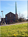
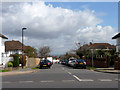
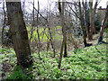
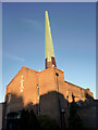

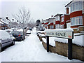
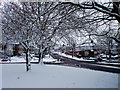
100 photos from this area
Area Information
Key information about the N14 4TE including its size, population, and administrative classification.
- Area Type
- Postcode
- Area Size
- 1.7 hectares
- Population
- 1726
- Population Density
- 5322 people/km²
House Prices in N14 4TE
21
Properties
£561,262
Average Sold Price
£135,000
Lowest Price
£985,000
Highest Price
Showing 21 properties
| Address | Type | Beds | Baths | Last Sale Price | Last Sale Date | |
|---|---|---|---|---|---|---|
| 37 Merrivale, Southgate, N14 4TE | Detached | 4 | 3 | £965,000 | Jan 2025 | |
| 59 Merrivale, Southgate, N14 4TE | Semi-detached | 3 | 1 | £735,000 | Jul 2024 | |
| 43 Merrivale, Southgate, N14 4TE | house | - | - | £985,000 | Nov 2021 | |
| 45 Merrivale, Southgate, N14 4TE | Semi-detached | 3 | 1 | £750,000 | Sep 2021 | |
| 21 Merrivale, Southgate, N14 4TE | Semi-detached | 4 | 2 | £750,000 | Jun 2021 | |
| 53 Merrivale, Southgate, N14 4TE | Semi-detached | 4 | 2 | £814,000 | Jun 2019 | |
| 61 Merrivale, Southgate, N14 4TE | Detached | 4 | 2 | £950,000 | Feb 2018 | |
| 35 Merrivale, Southgate, N14 4TE | house | - | - | £662,500 | Aug 2017 | |
| 57 Merrivale, Southgate, N14 4TE | Semi-detached | 3 | - | £495,000 | Jul 2013 | |
| 31 Merrivale, Southgate, N14 4TE | house | - | - | £560,000 | Dec 2012 |
Page 1 of 3
Energy Efficiency in N14 4TE
Amenities
Schools
| Rank | School | Type | Entry gender | Ages |
|---|
Explore more schools in this area
Go to Schools tabDemographics
Household Size
Family (3-5 people)
most common
Accommodation Type
Houses
most common
Tenure
86
majority
Ethnic Group
White
most common
Religion
N/A
most common
Household Composition
N/A
most common
Age
47
median
Adults (30-64 years)
most common
Household Deprivation
N/A
with no deprivation
NS-SEC
47
in Lower managerial occupations
Explore more demographic insights in this area
Go to Demographics tabPlanning
Planning Constraints
- Flood RiskPremium
- Ramsar Wetland SitesPremium
- Area of Outstanding Natural BeautyPremium
- Protected Nature ReservePremium
- Protected WoodlandPremium