Area Overview for N14 4TB
Photos of N14 4TB


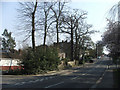
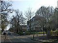


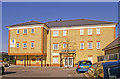
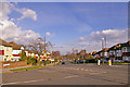
100 photos from this area
Area Information
Key information about the N14 4TB including its size, population, and administrative classification.
- Area Type
- Postcode
- Area Size
- 5770 m²
- Population
- 1817
- Population Density
- 8855 people/km²
House Prices in N14 4TB
12
Properties
£528,750
Average Sold Price
£354,995
Lowest Price
£800,000
Highest Price
Showing 12 properties
| Address | Type | Beds | Baths | Last Sale Price | Last Sale Date | |
|---|---|---|---|---|---|---|
| 170 Prince George Avenue, Southgate, N14 4TB | Semi-detached | 4 | - | £675,000 | Jul 2025 | |
| 158 Prince George Avenue, Southgate, N14 4TB | house | 3 | 2 | £800,000 | Sep 2022 | |
| 172 Prince George Avenue, Southgate, N14 4TB | house | - | - | £745,000 | Sep 2021 | |
| 156 Prince George Avenue, Southgate, N14 4TB | house | - | - | £785,000 | Jun 2021 | |
| 160 Prince George Avenue, Southgate, N14 4TB | house | - | - | £455,000 | Oct 2010 | |
| 168 Prince George Avenue, Southgate, N14 4TB | house | - | - | £380,000 | Feb 2010 | |
| 176 Prince George Avenue, Southgate, N14 4TB | Semi-detached | - | - | £365,000 | Oct 2006 | |
| 166 Prince George Avenue, Southgate, N14 4TB | Semi-detached | 4 | 2 | £371,500 | Sep 2006 | |
| 174 Prince George Avenue, Southgate, N14 4TB | Terraced | - | - | £354,995 | Mar 2004 | |
| 162 Prince George Avenue, Southgate, N14 4TB | Terraced | - | - | £356,000 | Jan 2004 |
Page 1 of 2
Energy Efficiency in N14 4TB
Amenities
Schools
| Rank | School | Type | Entry gender | Ages |
|---|
Explore more schools in this area
Go to Schools tabDemographics
Household Size
Family (3-5 people)
most common
Accommodation Type
Flats
most common
Tenure
57
majority
Ethnic Group
White
most common
Religion
N/A
most common
Household Composition
N/A
most common
Age
47
median
Adults (30-64 years)
most common
Household Deprivation
N/A
with no deprivation
NS-SEC
42
in Lower managerial occupations
Explore more demographic insights in this area
Go to Demographics tabPlanning
Planning Constraints
- Flood RiskPremium
- Ramsar Wetland SitesPremium
- Area of Outstanding Natural BeautyPremium
- Protected Nature ReservePremium
- Protected WoodlandPremium