Area Overview for N14 4SP
Photos of N14 4SP


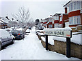
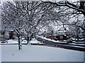
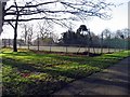
100 photos from this area
Area Information
Key information about the N14 4SP including its size, population, and administrative classification.
- Area Type
- Postcode
- Area Size
- 1.1 hectares
- Population
- 1726
- Population Density
- 5322 people/km²
House Prices in N14 4SP
18
Properties
£627,286
Average Sold Price
£145,000
Lowest Price
£970,000
Highest Price
Showing 18 properties
| Address | Type | Beds | Baths | Last Sale Price | Last Sale Date | |
|---|---|---|---|---|---|---|
| 80 Prince George Avenue, Southgate, N14 4SP | Semi-detached | 5 | 3 | £925,000 | Feb 2024 | |
| 68 Prince George Avenue, Southgate, N14 4SP | house | 5 | 2 | £950,000 | Feb 2023 | |
| 84 Prince George Avenue, Southgate, N14 4SP | house | - | - | £875,000 | Sep 2021 | |
| 86 Prince George Avenue, Southgate, N14 4SP | house | - | - | £890,000 | Dec 2020 | |
| 64 Prince George Avenue, Southgate, N14 4SP | Semi-detached | 5 | 1 | £970,000 | Mar 2020 | |
| 76 Prince George Avenue, Southgate, N14 4SP | Semi-detached | 4 | 2 | £730,000 | Oct 2015 | |
| 70 Prince George Avenue, Southgate, N14 4SP | house | - | - | £568,000 | Aug 2012 | |
| 58 Prince George Avenue, Southgate, N14 4SP | Terraced | 3 | - | £450,000 | Nov 2009 | |
| 90 Prince George Avenue, Southgate, N14 4SP | Semi-detached | - | - | £370,000 | Jun 2006 | |
| 82 Prince George Avenue, Southgate, N14 4SP | Semi-detached | - | - | £455,000 | Apr 2006 |
Page 1 of 2
Energy Efficiency in N14 4SP
Amenities
Schools
| Rank | School | Type | Entry gender | Ages |
|---|
Explore more schools in this area
Go to Schools tabDemographics
Household Size
Family (3-5 people)
most common
Accommodation Type
Houses
most common
Tenure
86
majority
Ethnic Group
White
most common
Religion
N/A
most common
Household Composition
N/A
most common
Age
47
median
Adults (30-64 years)
most common
Household Deprivation
N/A
with no deprivation
NS-SEC
47
in Lower managerial occupations
Explore more demographic insights in this area
Go to Demographics tabPlanning
Planning Constraints
- Flood RiskPremium
- Ramsar Wetland SitesPremium
- Area of Outstanding Natural BeautyPremium
- Protected Nature ReservePremium
- Protected WoodlandPremium