Area Overview for N14 4NB
Photos of N14 4NB
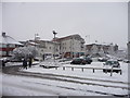
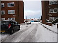
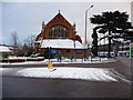
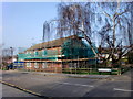
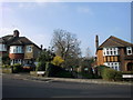
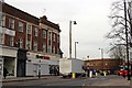
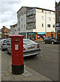
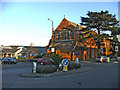
100 photos from this area
Area Information
Key information about the N14 4NB including its size, population, and administrative classification.
- Area Type
- Postcode
- Area Size
- 5290 m²
- Population
- 1964
- Population Density
- 8382 people/km²
House Prices in N14 4NB
18
Properties
£369,167
Average Sold Price
£148,000
Lowest Price
£570,000
Highest Price
Showing 18 properties
| Address | Type | Beds | Baths | Last Sale Price | Last Sale Date | |
|---|---|---|---|---|---|---|
| 27 Orchard Avenue, Southgate, N14 4NB | Semi-detached | 3 | 1 | £548,000 | Nov 2019 | |
| 19 Orchard Avenue, Southgate, N14 4NB | Semi-detached | 3 | 1 | £557,000 | May 2019 | |
| 15 Orchard Avenue, Southgate, N14 4NB | house | - | - | £570,000 | May 2017 | |
| 25 Orchard Avenue, Southgate, N14 4NB | Terraced | 3 | - | £400,000 | Jun 2014 | |
| 23 Orchard Avenue, Southgate, N14 4NB | Terraced | 3 | 1 | £385,000 | Dec 2013 | |
| 31 Orchard Avenue, Southgate, N14 4NB | house | - | - | £345,000 | Oct 2012 | |
| 33 Orchard Avenue, Southgate, N14 4NB | Terraced | - | - | £335,000 | Aug 2012 | |
| 29 Orchard Avenue, Southgate, N14 4NB | house | 3 | - | £392,000 | Oct 2011 | |
| 3 Orchard Avenue, Southgate, N14 4NB | house | 3 | - | £348,000 | Aug 2011 | |
| 9 Orchard Avenue, Southgate, N14 4NB | house | 3 | - | £372,500 | Jul 2010 |
Page 1 of 2
Energy Efficiency in N14 4NB
Amenities
Schools
| Rank | School | Type | Entry gender | Ages |
|---|
Explore more schools in this area
Go to Schools tabDemographics
Household Size
Family (3-5 people)
most common
Accommodation Type
Houses
most common
Tenure
63
majority
Ethnic Group
White
most common
Religion
N/A
most common
Household Composition
N/A
most common
Age
47
median
Adults (30-64 years)
most common
Household Deprivation
N/A
with no deprivation
NS-SEC
35
in Lower managerial occupations
Explore more demographic insights in this area
Go to Demographics tabPlanning
Planning Constraints
- Flood RiskPremium
- Ramsar Wetland SitesPremium
- Area of Outstanding Natural BeautyPremium
- Protected Nature ReservePremium
- Protected WoodlandPremium