Area Overview for N14 4LU
Photos of N14 4LU
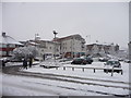
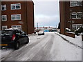
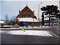
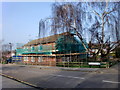
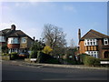
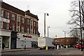
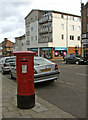
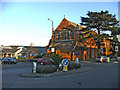
100 photos from this area
Area Information
Key information about the N14 4LU including its size, population, and administrative classification.
- Area Type
- Postcode
- Area Size
- 8722 m²
- Population
- 1964
- Population Density
- 8382 people/km²
House Prices in N14 4LU
23
Properties
£382,425
Average Sold Price
£91,000
Lowest Price
£710,000
Highest Price
Showing 23 properties
| Address | Type | Beds | Baths | Last Sale Price | Last Sale Date | |
|---|---|---|---|---|---|---|
| 12 Linden Way, Southgate, N14 4LU | house | - | - | £645,000 | Mar 2022 | |
| 26 Linden Way, Southgate, N14 4LU | Terraced | 3 | 1 | £710,000 | Nov 2021 | |
| 10 Linden Way, Southgate, N14 4LU | Terraced | 3 | - | £675,000 | Nov 2020 | |
| 14 Linden Way, Southgate, N14 4LU | Terraced | 3 | 1 | £530,000 | Apr 2019 | |
| 2 Linden Way, Southgate, N14 4LU | house | - | - | £675,000 | Mar 2016 | |
| 18 Linden Way, Southgate, N14 4LU | house | - | - | £405,000 | Jul 2012 | |
| 30 Linden Way, Southgate, N14 4LU | Terraced | - | - | £330,000 | Jan 2008 | |
| 6 Linden Way, Southgate, N14 4LU | Terraced | - | - | £320,000 | Sep 2007 | |
| 8 Linden Way, Southgate, N14 4LU | Flat | 2 | 2 | £345,000 | Sep 2006 | |
| 32 Linden Way, Southgate, N14 4LU | Terraced | - | - | £249,950 | Apr 2003 |
Page 1 of 3
Energy Efficiency in N14 4LU
Amenities
Schools
| Rank | School | Type | Entry gender | Ages |
|---|
Explore more schools in this area
Go to Schools tabDemographics
Household Size
Family (3-5 people)
most common
Accommodation Type
Houses
most common
Tenure
63
majority
Ethnic Group
White
most common
Religion
N/A
most common
Household Composition
N/A
most common
Age
47
median
Adults (30-64 years)
most common
Household Deprivation
N/A
with no deprivation
NS-SEC
35
in Lower managerial occupations
Explore more demographic insights in this area
Go to Demographics tabPlanning
Planning Constraints
- Flood RiskPremium
- Ramsar Wetland SitesPremium
- Area of Outstanding Natural BeautyPremium
- Protected Nature ReservePremium
- Protected WoodlandPremium