Area Overview for N14 4LQ
Photos of N14 4LQ
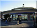
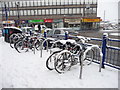
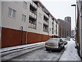
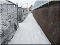
100 photos from this area
Area Information
Key information about the N14 4LQ including its size, population, and administrative classification.
- Area Type
- Postcode
- Area Size
- 1.8 hectares
- Population
- 1562
- Population Density
- 6061 people/km²
House Prices in N14 4LQ
69
Properties
£166,448
Average Sold Price
£46,500
Lowest Price
£335,000
Highest Price
Showing 69 properties
| Address | Type | Beds | Baths | Last Sale Price | Last Sale Date | |
|---|---|---|---|---|---|---|
| 102 Dalrymple Close, Southgate, N14 4LQ | Flat | 1 | 1 | £245,000 | Sep 2025 | |
| 97 Dalrymple Close, Southgate, N14 4LQ | Flat | 2 | 1 | £335,000 | Jul 2024 | |
| 118 Dalrymple Close, Southgate, N14 4LQ | Flat | 2 | 1 | £270,000 | Apr 2024 | |
| 106 Dalrymple Close, Southgate, N14 4LQ | Flat | - | - | £285,000 | Apr 2024 | |
| 100 Dalrymple Close, Southgate, N14 4LQ | Flat | - | 1 | £210,000 | Nov 2023 | |
| 113 Dalrymple Close, Southgate, N14 4LQ | Flat | 2 | 1 | £315,000 | Mar 2022 | |
| 98 Dalrymple Close, Southgate, N14 4LQ | Flat | 2 | 1 | £327,000 | Feb 2020 | |
| 138 Dalrymple Close, Southgate, N14 4LQ | Flat | 1 | 1 | £272,500 | Jan 2018 | |
| 92 Dalrymple Close, Southgate, N14 4LQ | Flat | - | - | £305,000 | Sep 2017 | |
| 133 Dalrymple Close, Southgate, N14 4LQ | Flat | - | - | £265,000 | Aug 2017 |
Page 1 of 7
Energy Efficiency in N14 4LQ
Amenities
Schools
| Rank | School | Type | Entry gender | Ages |
|---|
Explore more schools in this area
Go to Schools tabDemographics
Household Size
Family (3-5 people)
most common
Accommodation Type
Houses
most common
Tenure
58
majority
Ethnic Group
White
most common
Religion
N/A
most common
Household Composition
N/A
most common
Age
47
median
Adults (30-64 years)
most common
Household Deprivation
N/A
with no deprivation
NS-SEC
38
in Lower managerial occupations
Explore more demographic insights in this area
Go to Demographics tabPlanning
Planning Constraints
- Flood RiskPremium
- Ramsar Wetland SitesPremium
- Area of Outstanding Natural BeautyPremium
- Protected Nature ReservePremium
- Protected WoodlandPremium