Area Overview for N13 6HF
Photos of N13 6HF
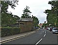
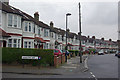
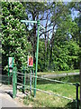
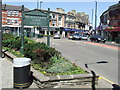

100 photos from this area
Area Information
Key information about the N13 6HF including its size, population, and administrative classification.
- Area Type
- Postcode
- Area Size
- 1.7 hectares
- Population
- 2164
- Population Density
- 7240 people/km²
House Prices in N13 6HF
43
Properties
£264,680
Average Sold Price
£86,000
Lowest Price
£350,000
Highest Price
Showing 43 properties
| Address | Type | Beds | Baths | Last Sale Price | Last Sale Date | |
|---|---|---|---|---|---|---|
| 31 Millicent Grove, Southgate, N13 6HF | Flat | 2 | 1 | £300,000 | Mar 2025 | |
| 35 Millicent Grove, Southgate, N13 6HF | Flat | - | - | £140,000 | Jun 2024 | |
| 39 Millicent Grove, Southgate, N13 6HF | Flat | - | - | £307,500 | Aug 2020 | |
| 33 Millicent Grove, Southgate, N13 6HF | Flat | - | - | £130,000 | Nov 2018 | |
| 41 Millicent Grove, Southgate, N13 6HF | Flat | - | - | £86,000 | Mar 2010 | |
| 3 Millicent Grove, Southgate, N13 6HF | house | 4 | - | £315,000 | Aug 2009 | |
| 13 Millicent Grove, Southgate, N13 6HF | house | - | - | £345,000 | Aug 2009 | |
| 1 Millicent Grove, Southgate, N13 6HF | house | - | - | £350,000 | Aug 2009 | |
| 5 Millicent Grove, Southgate, N13 6HF | house | - | - | £335,000 | Jul 2009 | |
| 7 Millicent Grove, Southgate, N13 6HF | house | - | - | £338,300 | Jul 2009 |
Page 1 of 5
Energy Efficiency in N13 6HF
Amenities
Schools
| Rank | School | Type | Entry gender | Ages |
|---|
Explore more schools in this area
Go to Schools tabDemographics
Household Size
Family (3-5 people)
most common
Accommodation Type
Flats
most common
Tenure
48
majority
Ethnic Group
White
most common
Religion
N/A
most common
Household Composition
N/A
most common
Age
47
median
Adults (30-64 years)
most common
Household Deprivation
N/A
with no deprivation
NS-SEC
27
in Lower managerial occupations
Explore more demographic insights in this area
Go to Demographics tabPlanning
Planning Constraints
- Flood RiskPremium
- Ramsar Wetland SitesPremium
- Area of Outstanding Natural BeautyPremium
- Protected Nature ReservePremium
- Protected WoodlandPremium