Area Overview for N13 6AL
Photos of N13 6AL
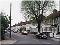
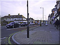
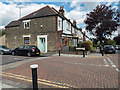

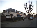
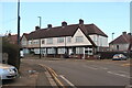
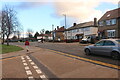


35 photos from this area
Area Information
Key information about the N13 6AL including its size, population, and administrative classification.
- Area Type
- Postcode
- Area Size
- 1.8 hectares
- Population
- 1736
- Population Density
- 7688 people/km²
House Prices in N13 6AL
35
Properties
£377,977
Average Sold Price
£80,000
Lowest Price
£670,000
Highest Price
Showing 35 properties
| Address | Type | Beds | Baths | Last Sale Price | Last Sale Date | |
|---|---|---|---|---|---|---|
| 95 Norfolk Avenue, Wood Green, London, N13 6AL | Terraced | 3 | 2 | £545,000 | Mar 2025 | |
| 85 Norfolk Avenue, Wood Green, London, N13 6AL | Terraced | 5 | 2 | £670,000 | Mar 2025 | |
| 99 Norfolk Avenue, Wood Green, London, N13 6AL | Semi-detached | 4 | 2 | £640,000 | Sep 2024 | |
| 135 Norfolk Avenue, Wood Green, London, N13 6AL | house | 3 | 1 | £580,000 | Oct 2023 | |
| 139 Norfolk Avenue, Wood Green, London, N13 6AL | Terraced | 3 | 1 | £515,000 | Oct 2022 | |
| 123 Norfolk Avenue, Wood Green, London, N13 6AL | house | - | - | £525,000 | Jun 2021 | |
| 91 Norfolk Avenue, Wood Green, London, N13 6AL | Terraced | 3 | 1 | £460,000 | Jun 2021 | |
| 89 Norfolk Avenue, Wood Green, London, N13 6AL | house | 3 | 2 | £418,000 | Apr 2019 | |
| 103 Norfolk Avenue, Wood Green, London, N13 6AL | house | 3 | 1 | £445,000 | Jan 2019 | |
| 97 Norfolk Avenue, Wood Green, London, N13 6AL | Semi-detached | 3 | - | £570,000 | Aug 2017 |
Page 1 of 4
Energy Efficiency in N13 6AL
Amenities
Schools
| Rank | School | Type | Entry gender | Ages |
|---|
Explore more schools in this area
Go to Schools tabDemographics
Household Size
Family (3-5 people)
most common
Accommodation Type
Houses
most common
Tenure
50
majority
Ethnic Group
White
most common
Religion
N/A
most common
Household Composition
N/A
most common
Age
47
median
Adults (30-64 years)
most common
Household Deprivation
N/A
with no deprivation
NS-SEC
26
in Lower managerial occupations
Explore more demographic insights in this area
Go to Demographics tabPlanning
Planning Constraints
- Flood RiskPremium
- Ramsar Wetland SitesPremium
- Area of Outstanding Natural BeautyPremium
- Protected Nature ReservePremium
- Protected WoodlandPremium