Area Overview for N13 6AG
Photos of N13 6AG
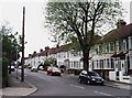
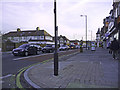
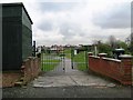
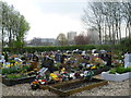
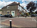
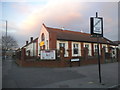
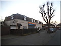
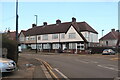
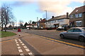

35 photos from this area
Area Information
Key information about the N13 6AG including its size, population, and administrative classification.
- Area Type
- Postcode
- Area Size
- 3.1 hectares
- Population
- 1980
- Population Density
- 9626 people/km²
House Prices in N13 6AG
39
Properties
£382,578
Average Sold Price
£60,000
Lowest Price
£770,000
Highest Price
Showing 39 properties
| Address | Type | Beds | Baths | Last Sale Price | Last Sale Date | |
|---|---|---|---|---|---|---|
| 2 Norfolk Avenue, Southgate, N13 6AG | Flat | 1 | 1 | £770,000 | May 2022 | |
| 58 Norfolk Avenue, Southgate, N13 6AG | Retail | 3 | 1 | £690,000 | May 2022 | |
| 52 Norfolk Avenue, Southgate, N13 6AG | house | - | - | £735,000 | Jan 2022 | |
| 30 Norfolk Avenue, Southgate, N13 6AG | Terraced | 3 | 2 | £651,000 | Jul 2021 | |
| 12 Norfolk Avenue, Southgate, N13 6AG | Terraced | 3 | 1 | £720,000 | Jul 2019 | |
| 4 Norfolk Avenue, Southgate, N13 6AG | house | 4 | 1 | £640,000 | Feb 2019 | |
| 6 Norfolk Avenue, Southgate, N13 6AG | Terraced | 3 | 2 | £465,000 | Nov 2013 | |
| 14 Norfolk Avenue, Southgate, N13 6AG | house | 4 | - | £457,500 | Nov 2012 | |
| 18 Norfolk Avenue, Southgate, N13 6AG | house | - | - | £325,000 | Jun 2011 | |
| 26 Norfolk Avenue, Southgate, N13 6AG | Terraced | 1 | 2 | £290,000 | Aug 2009 |
Page 1 of 4
Energy Efficiency in N13 6AG
Amenities
Schools
| Rank | School | Type | Entry gender | Ages |
|---|
Explore more schools in this area
Go to Schools tabDemographics
Household Size
Family (3-5 people)
most common
Accommodation Type
Flats
most common
Tenure
42
majority
Ethnic Group
White
most common
Religion
N/A
most common
Household Composition
N/A
most common
Age
47
median
Adults (30-64 years)
most common
Household Deprivation
N/A
with no deprivation
NS-SEC
35
in Lower managerial occupations
Explore more demographic insights in this area
Go to Demographics tabPlanning
Planning Constraints
- Flood RiskPremium
- Ramsar Wetland SitesPremium
- Area of Outstanding Natural BeautyPremium
- Protected Nature ReservePremium
- Protected WoodlandPremium