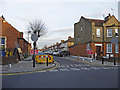
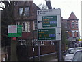
Area Overview for N13 4XB
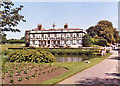
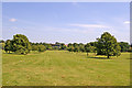
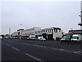
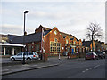
Photos of N13 4XB


Area Information
N13 4XB is a small residential postcode area in England, home to around 2220 residents. It is a compact cluster of properties, predominantly flats, serving a community of adults aged 30–64, with a median age of 47. The area’s proximity to key transport hubs and local amenities makes it a practical choice for commuters and families. Residents benefit from nearby schools, retail outlets, and multiple rail and metro stations, ensuring connectivity to central London and surrounding suburbs. While the area lacks large-scale natural features, its strategic location near Palmers Green and Wood Green offers a balance of urban convenience and access to green spaces. The community is tightly knit, with a focus on practical living, though the higher-than-average crime risk necessitates awareness of local safety measures. For buyers seeking a manageable, well-served postcode with direct links to London’s transport network, N13 4XB presents a straightforward proposition.
- Area Type
- Postcode
- Area Size
- Not available
- Population
- 2220
- Population Density
- 7322 people/km²
The property market in N13 4XB is defined by a high concentration of flats, with 40% of residents owning their homes. This suggests a rental-heavy market, where flats are the primary housing stock. The area’s small size and residential focus mean property options are limited to flats rather than detached or semi-detached homes. Buyers should consider that the market is not geared toward first-time buyers seeking larger properties, but rather those prioritising proximity to transport and amenities. The flat-dominated landscape may appeal to professionals or couples without children, though the lack of diverse housing types could limit options for growing families. The area’s immediate surroundings offer similar characteristics, reinforcing that N13 4XB is part of a broader network of compact, urban housing.
House Prices in N13 4XB
No properties found in this postcode.
Energy Efficiency in N13 4XB
Daily life in N13 4XB is shaped by its proximity to retail, transport, and leisure facilities. Residents can access major supermarkets like Morrisons, Tesco, and Sainsburys, ensuring convenience for shopping. The area’s transport network, including rail, metro, and ferry services, connects it to cultural landmarks such as London Zoo and central London’s business districts. The nearby Alexandra Palace Station and Wood Green Station offer easy access to entertainment and employment hubs. While the area lacks large parks or recreational spaces, the surrounding suburbs provide opportunities for outdoor activities. The mix of retail and transport options fosters a practical, commuter-friendly lifestyle, though the absence of detailed leisure data means the full extent of recreational opportunities remains unspecified.
Amenities
Schools
Two primary schools are within reach of N13 4XB: St Anne’s Catholic High School for Girls, which holds an Ofsted rating of outstanding, and St Angela’s RC School for Girls. Both institutions cater to young female students, offering a focused educational environment. The presence of two primary schools provides families with options, though the data does not indicate secondary education facilities nearby. The mix of schools suggests a community prioritising early education, with a strong emphasis on Catholic schooling. Parents should consider the specific needs of their children, as the area lacks information on secondary schools or broader educational provisions.
| Rank | School | Type | Entry gender | Ages |
|---|
Explore more schools in this area
Go to Schools tabDemographics
The population of N13 4XB is 2220, with a median age of 47. Over 60% of residents fall within the 30–64 age range, reflecting a mature adult demographic. Home ownership is relatively low at 40%, indicating a significant proportion of residents rent their homes. The area is characterised by flats, which dominate the accommodation type. The predominant ethnic group is White, though specific diversity statistics are not provided. This age profile suggests a community focused on stability and long-term living, with fewer young families compared to other areas. The absence of detailed deprivation data means the quality of life remains unquantified, but the mix of renters and owners implies a pragmatic approach to housing. The age range also suggests a workforce likely engaged in local or regional employment, with limited data on occupational trends.
Household Size
Accommodation Type
Tenure
Ethnic Group
Religion
Household Composition
Age
Household Deprivation
NS-SEC
Explore more demographic insights in this area
Go to Demographics tabPlanning
Planning Constraints
- Flood RiskPremium
- Ramsar Wetland SitesPremium
- Area of Outstanding Natural BeautyPremium
- Protected Nature ReservePremium
- Protected WoodlandPremium