Area Overview for N12 9RL
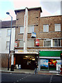
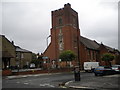
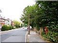
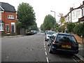
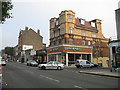
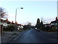
Photos of N12 9RL


Area Information
N12 9RL is a small residential postcode in England, home to 1961 residents. It is a compact area defined by its cluster of flats, offering a mix of practical living spaces in a setting that balances urban convenience with relative tranquillity. The population, while modest, suggests a tightly knit community with a median age of 47, indicating a predominance of adults in their 30s to 60s. Daily life here is shaped by proximity to essential services and transport links, making it appealing for those prioritising accessibility. The area’s safety profile is strong, with low flood risk and below-average crime rates. Residents benefit from nearby retail options, public transport hubs, and water-based connectivity, creating a functional environment for both work and leisure. For buyers, N12 9RL represents a focused opportunity to invest in a well-serviced, low-risk postcode with a clear demographic profile.
- Area Type
- Postcode
- Area Size
- Not available
- Population
- 1961
- Population Density
- 11199 people/km²
The property market in N12 9RL is characterised by a high proportion of flats, with 43% of homes owner-occupied. This indicates a rental market that is active, as the remaining properties are likely occupied by tenants. The prevalence of flats suggests a focus on compact, manageable living spaces, which may appeal to professionals or families seeking convenience over larger homes. Given the small size of the area, buyers should consider the limited housing stock and potential competition for available properties. The flat-dominated market may also influence property values, with prices potentially reflecting the demand for urban living in a well-connected postcode. Investors or buyers seeking a foothold in this area should evaluate the balance between rental demand and ownership opportunities.
House Prices in N12 9RL
No properties found in this postcode.
Energy Efficiency in N12 9RL
Living in N12 9RL offers access to a range of amenities that support both daily needs and leisure. The area is served by five retail outlets, including Sainsburys North, Tesco North, and Aldi North, ensuring easy access to groceries and household essentials. Public transport is extensive, with metro stations like Woodside Park and Totteridge & Whetstone providing connections to central London, while rail options such as New Barnet Station offer links to broader regional routes. Water-based transport is also available, with Camden Lock Waterbus and London Zoo Waterbus Stop offering scenic alternatives. Parks and green spaces are not explicitly mentioned in the data, but the absence of environmental constraints suggests open areas may be accessible nearby. This mix of retail, transport, and connectivity creates a lifestyle that balances practicality with urban vibrancy.
Amenities
Schools
| Rank | School | Type | Entry gender | Ages |
|---|
Explore more schools in this area
Go to Schools tabDemographics
The community in N12 9RL is predominantly composed of adults aged 30 to 64, with a median age of 47. This suggests a mature, stable population, likely including families and professionals. Home ownership accounts for 43% of households, indicating a mix of owner-occupied properties and rental units. The accommodation type is primarily flats, reflecting a residential cluster suited to urban living rather than detached homes. The predominant ethnic group is White, which aligns with broader trends in the region. With a population of 1961, the area is small but cohesive, offering a sense of familiarity. The demographic profile suggests a community focused on practicality and stability, with residents likely prioritising proximity to services and transport over expansive living spaces.
Household Size
Accommodation Type
Tenure
Ethnic Group
Religion
Household Composition
Age
Household Deprivation
NS-SEC
Explore more demographic insights in this area
Go to Demographics tabPlanning
Planning Constraints
- Flood RiskPremium
- Ramsar Wetland SitesPremium
- Area of Outstanding Natural BeautyPremium
- Protected Nature ReservePremium
- Protected WoodlandPremium