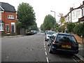
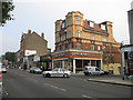
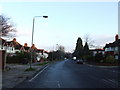
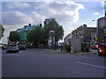
Area Overview for N12 9PX
Photos of N12 9PX


Area Information
Living in N12 9PX means being part of a tightly knit residential cluster in north London, where the population of 2,367 reflects a quiet, established community. This postcode area is characterised by its compact size and proximity to key transport routes, making it a practical choice for commuters. The area’s demographics suggest a mature population, with a median age of 47 and a majority of residents aged 30–64. Daily life here is shaped by the availability of nearby amenities, including retail outlets like Aldi, Tesco, and Waitrose, as well as multiple train and metro stations. The presence of Sacks Morasha Jewish Primary School, rated ‘good’ by Ofsted, adds to the area’s appeal for families. While N12 9PX lacks natural or protected landscapes, its strategic location near Finchley Central Station and surrounding transport hubs ensures easy access to the city. The area’s modest size means residents are likely to know their neighbours, though the 34% home ownership rate suggests a significant rental market. For those seeking a balance between convenience and a settled community, N12 9PX offers a straightforward, no-frills lifestyle.
- Area Type
- Postcode
- Area Size
- Not available
- Population
- 2367
- Population Density
- 11050 people/km²
The property market in N12 9PX is dominated by flats, with 34% of homes owned by residents and the remainder likely rented. This suggests a rental market that caters to those seeking short-term or flexible housing solutions. The predominance of flats may indicate a focus on affordability and space efficiency, which is typical in densely populated urban areas. For buyers, this means the area is not ideal for those seeking larger properties or long-term ownership, as the home ownership rate is comparatively low. The small size of the postcode area also limits the variety of housing stock available, meaning buyers must consider nearby zones for more options. The lack of protected or natural landscapes, combined with the proximity to transport links, positions N12 9PX as a pragmatic choice for commuters or those prioritising convenience over property value growth. Potential buyers should weigh the rental market dynamics against their long-term goals, as the area may not be suited to those seeking equity accumulation through homeownership.
House Prices in N12 9PX
No properties found in this postcode.
Energy Efficiency in N12 9PX
The lifestyle in N12 9PX is shaped by its proximity to a range of practical amenities. Retail options include Aldi North, Tesco North, and Waitrose Finchley, providing residents with access to essential shopping. The area’s transport links also open up leisure opportunities, with nearby stations connecting to parks, cultural sites, and the London Zoo via waterbus. The presence of multiple rail and metro stations, such as West Finchley and Bowes Park, ensures easy access to dining, entertainment, and employment hubs. While the area itself lacks large parks or recreational spaces, its strategic location allows residents to enjoy nearby green spaces and amenities. The character of daily life here is defined by convenience, with a focus on efficient shopping, commuting, and access to city-wide attractions. The absence of major landmarks or natural features means the area’s appeal lies in its functionality, making it suitable for those who value accessibility over scenic environments.
Amenities
Schools
The primary school nearest to N12 9PX is Sacks Morasha Jewish Primary School, which serves the local community with a ‘good’ Ofsted rating. This institution is listed twice in the data, but it is the only school explicitly named for the area. As a Jewish primary school, it caters to a specific demographic, though no other schools are mentioned in the data. Families seeking a range of educational options may find the area limited in terms of school diversity, as no secondary schools or other primary institutions are referenced. The presence of a rated school is a positive factor for those prioritising education, but the absence of additional schools suggests a need for nearby options. Parents should consider the broader Finchley area for a more comprehensive selection of schools, as N12 9PX itself offers only one educational institution.
| Rank | School | Type | Entry gender | Ages |
|---|
Explore more schools in this area
Go to Schools tabDemographics
The population of N12 9PX is 2,367, with a median age of 47, indicating a predominantly adult population. The most common age range is 30–64 years, suggesting a mature, stable community. Home ownership is relatively low at 34%, which points to a rental-heavy market. The primary accommodation type is flats, reflecting a housing stock suited to smaller households or couples. The predominant ethnic group is White, though no specific data on diversity or deprivation is provided. This demographic profile implies a community focused on practical living, with fewer young families compared to areas with higher home ownership rates. The age range also suggests a population that may be nearing retirement or in their peak working years, potentially influencing local services and amenities. The absence of detailed diversity statistics means the area’s cultural composition remains less defined, but the presence of a Jewish primary school hints at specific community needs being met.
Household Size
Accommodation Type
Tenure
Ethnic Group
Religion
Household Composition
Age
Household Deprivation
NS-SEC
Explore more demographic insights in this area
Go to Demographics tabPlanning
Planning Constraints
- Flood RiskPremium
- Ramsar Wetland SitesPremium
- Area of Outstanding Natural BeautyPremium
- Protected Nature ReservePremium
- Protected WoodlandPremium