Area Overview for N12 9JL
Photos of N12 9JL

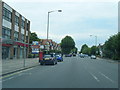


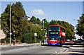

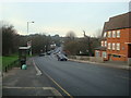

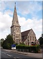


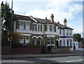
86 photos from this area
Area Information
Key information about the N12 9JL including its size, population, and administrative classification.
- Area Type
- Postcode
- Area Size
- 1.7 hectares
- Population
- 1436
- Population Density
- 2236 people/km²
House Prices in N12 9JL
23
Properties
£663,286
Average Sold Price
£105,000
Lowest Price
£1,000,000
Highest Price
Showing 23 properties
| Address | Type | Beds | Baths | Last Sale Price | Last Sale Date | |
|---|---|---|---|---|---|---|
| 84 Finchley Park, North Finchley, London, N12 9JL | Semi-detached | 4 | 2 | £900,000 | Aug 2025 | |
| 88 Finchley Park, North Finchley, London, N12 9JL | house | 4 | 2 | £927,500 | Jun 2024 | |
| 68 Finchley Park, North Finchley, London, N12 9JL | Cottage | 3 | 1 | £600,000 | Apr 2024 | |
| 92 Finchley Park, North Finchley, London, N12 9JL | Semi-detached | 4 | 1 | £800,000 | Mar 2024 | |
| 98 Finchley Park, North Finchley, London, N12 9JL | Semi-detached | 3 | 1 | £825,000 | Jul 2023 | |
| 96 Finchley Park, North Finchley, London, N12 9JL | Semi-detached | 3 | 2 | £815,000 | Jan 2023 | |
| 46 Finchley Park, North Finchley, London, N12 9JL | Terraced | 3 | 1 | £730,000 | Aug 2021 | |
| 70 Finchley Park, North Finchley, London, N12 9JL | Semi-detached | 2 | - | £630,000 | Sep 2019 | |
| 66 Finchley Park, North Finchley, London, N12 9JL | Semi-detached | 2 | - | £530,000 | Dec 2018 | |
| 50 Finchley Park, North Finchley, London, N12 9JL | house | 3 | - | £1,000,000 | Jun 2017 |
Page 1 of 3
Energy Efficiency in N12 9JL
Amenities
Schools
| Rank | School | Type | Entry gender | Ages |
|---|
Explore more schools in this area
Go to Schools tabDemographics
Household Size
Family (3-5 people)
most common
Accommodation Type
Houses
most common
Tenure
90
majority
Ethnic Group
White
most common
Religion
N/A
most common
Household Composition
N/A
most common
Age
47
median
Adults (30-64 years)
most common
Household Deprivation
N/A
with no deprivation
NS-SEC
52
in Lower managerial occupations
Explore more demographic insights in this area
Go to Demographics tabPlanning
Planning Constraints
- Flood RiskPremium
- Ramsar Wetland SitesPremium
- Area of Outstanding Natural BeautyPremium
- Protected Nature ReservePremium
- Protected WoodlandPremium