Area Overview for N12 9BX
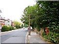
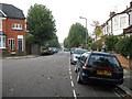
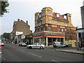
Photos of N12 9BX


Area Information
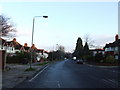
Living in N12 9BX means being part of a small, tightly knit residential cluster in north London. With a population of 2,367, the area is compact but well-served by nearby amenities and transport links. The community here is predominantly composed of adults aged 30–64, reflecting a mature demographic. Daily life balances convenience with suburban tranquillity, with residents able to access shops, schools, and public transport within short distances. The area’s small size means it is not densely populated, offering a quieter alternative to larger urban centres. Despite its modest scale, N12 9BX is strategically positioned near key infrastructure, including multiple metro and rail stations, which ease commutes to central London or surrounding boroughs. The housing stock is largely flat-based, catering to a mix of renters and owner-occupiers, though home ownership remains relatively low at 34%. For those seeking a manageable, accessible community with a focus on practicality, N12 9BX provides a straightforward, no-frills living environment.
- Area Type
- Postcode
- Area Size
- Not available
- Population
- 2367
- Population Density
- 11050 people/km²
The property market in N12 9BX is characterised by a low home ownership rate of 34%, indicating that the majority of residents rent their homes. The accommodation type is predominantly flats, which is typical for smaller, densely populated areas. This suggests a rental market that caters to individuals or couples seeking affordable, manageable housing. The small size of the area means the housing stock is limited, with few new developments likely to expand the market. For buyers, this could present challenges, as the number of available properties for purchase is restricted. However, the presence of flats may appeal to those prioritising convenience and proximity to transport links. Given the area’s compact nature, property prices are unlikely to be inflated by speculative demand, making it a potentially stable but niche market for those seeking a straightforward, low-maintenance living environment.
House Prices in N12 9BX
No properties found in this postcode.
Energy Efficiency in N12 9BX
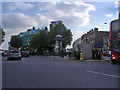
Life in N12 9BX is defined by its accessibility to a mix of retail, transport, and leisure options. The area’s five retail outlets, including major chains like Tesco and Sainsburys, provide convenient shopping for daily essentials. For transport, residents can choose from five metro stations, such as Woodside Park and Totteridge & Whetstone, which connect to London’s extensive network. Rail services at New Southgate and New Barnet stations offer further commuting flexibility. Leisure opportunities include ferry services like the Camden Lock Waterbus, which may appeal to those interested in scenic travel or visiting attractions such as London Zoo. The proximity to these amenities ensures a practical, well-rounded lifestyle, with minimal need to travel far for shopping, work, or recreation. The area’s compact nature fosters a sense of immediacy, where residents can access most services within a short distance.
Amenities
Schools
The nearest school to N12 9BX is Sacks Morasha Jewish Primary School, a primary school with an Ofsted rating of ‘good’. This institution serves the local community, offering education for younger children in a setting that aligns with Jewish cultural and religious practices. The presence of a primary school within the area is significant for families with young children, though no secondary schools are listed in the data. The school’s ‘good’ rating suggests a satisfactory standard of education, though parents may need to consider additional options for secondary schooling. The single school listed reflects the area’s small size, which may limit the variety of educational institutions available. For families prioritising proximity to a primary school, N12 9BX provides a direct option, but further research would be needed for secondary education.
| Rank | School | Type | Entry gender | Ages |
|---|
Explore more schools in this area
Go to Schools tabDemographics
The population of N12 9BX is 2,367, with a median age of 47, indicating a mature community. The most common age range is adults aged 30–64, suggesting a stable, working-age population. Home ownership in the area is 34%, meaning most residents rent their homes. The predominant accommodation type is flats, which aligns with the area’s compact nature. The majority of the population identifies as White, though no specific diversity statistics are provided. This demographic profile suggests a community focused on long-term stability, with fewer young families or students. The relatively low home ownership rate may reflect a rental market prioritising affordability over property investment. The absence of detailed data on deprivation means it is unclear how this affects access to services, but the area’s proximity to amenities implies a reasonable standard of living.
Household Size
Accommodation Type
Tenure
Ethnic Group
Religion
Household Composition
Age
Household Deprivation
NS-SEC
Explore more demographic insights in this area
Go to Demographics tabPlanning
Planning Constraints
- Flood RiskPremium
- Ramsar Wetland SitesPremium
- Area of Outstanding Natural BeautyPremium
- Protected Nature ReservePremium
- Protected WoodlandPremium