Area Overview for N12 9BP
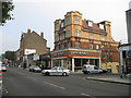
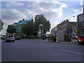
Photos of N12 9BP


Area Information
Living in N12 9BP means being part of a small, tightly knit residential cluster in north London, where the population of 2,219 residents reflects a mature, stable community. The area is characterised by its compact size and proximity to key transport links, making it a practical choice for those seeking a balance between urban convenience and residential tranquillity. With a median age of 47 and a majority of residents aged between 30 and 64, the community is predominantly composed of working-age adults, many of whom may be professionals or families. The area’s housing stock, largely comprising flats, suggests a mix of owner-occupied and rental properties, though only 41% of homes are owner-occupied. Daily life here is shaped by the availability of nearby amenities, from retail outlets to public transport hubs, while the absence of major environmental constraints ensures a straightforward planning landscape for residents.
- Area Type
- Postcode
- Area Size
- Not available
- Population
- 2219
- Population Density
- 13432 people/km²
The property market in N12 9BP is shaped by its small size and the predominance of flats as the primary accommodation type. With only 41% of homes owner-occupied, the area leans more towards a rental market than a buyer’s market. This suggests that the housing stock is largely targeted at tenants, possibly due to the compact nature of the postcode and the limited availability of larger properties. The presence of flats indicates a focus on high-density living, which may appeal to those prioritising convenience over space. For buyers, this means competition for owner-occupied properties is likely to be fierce, with fewer options available. The immediate surroundings may offer more variety, but within N12 9BP itself, the market is constrained by the small population and limited housing stock.
House Prices in N12 9BP
No properties found in this postcode.
Energy Efficiency in N12 9BP
The lifestyle in N12 9BP is supported by a range of nearby amenities, from retail to transport. The area’s retail landscape includes five notable stores, such as Tesco North and Aldi North, providing everyday shopping convenience. Public transport is extensive, with five metro stations, five rail stations, and ferry access at Camden Lock Waterbus and London Zoo Waterbus Stop. These options ensure residents can easily reach nearby attractions or work locations. While the data does not mention parks or leisure facilities explicitly, the absence of environmental constraints like protected woodlands or AONB areas suggests open space may be limited. Nonetheless, the variety of transport and retail options contributes to a practical, accessible lifestyle.
Amenities
Schools
The nearest school to N12 9BP is Northside Primary School, which holds a ‘good’ Ofsted rating. As a primary school, it serves the needs of younger children in the area, though no secondary schools are listed in the data. The presence of a rated primary school suggests that families with young children may find the area suitable for their educational needs. However, the absence of secondary schools nearby could require students to travel further for secondary education, which may impact daily routines. The single school listed indicates a limited range of educational options, which could be a consideration for families planning long-term in the area.
| Rank | School | Type | Entry gender | Ages |
|---|
Explore more schools in this area
Go to Schools tabDemographics
The demographic profile of N12 9BP is defined by its mature population, with a median age of 47 and the majority of residents falling within the 30-64 age range. This suggests a community of established professionals and families, with fewer younger or elderly residents. Home ownership is relatively low at 41%, indicating that a significant portion of the housing stock is occupied by renters. The accommodation type is predominantly flats, reflecting a design suited to urban living. The predominant ethnic group is White, though specific data on diversity or deprivation is not provided. The age profile implies a stable, long-term resident base, with fewer transient populations. This demographic structure may influence local services and amenities, catering to the needs of middle-aged adults and families rather than younger or older demographics.
Household Size
Accommodation Type
Tenure
Ethnic Group
Religion
Household Composition
Age
Household Deprivation
NS-SEC
Explore more demographic insights in this area
Go to Demographics tabPlanning
Planning Constraints
- Flood RiskPremium
- Ramsar Wetland SitesPremium
- Area of Outstanding Natural BeautyPremium
- Protected Nature ReservePremium
- Protected WoodlandPremium