Area Overview for N12 8PX
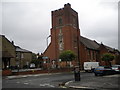
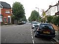
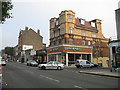
Photos of N12 8PX


Area Information
Living in N12 8PX means inhabiting a compact residential cluster in north London, where the population of 1961 residents reflects a tightly knit community. This area is characterised by its proximity to transport hubs and retail centres, making daily life convenient. The median age of 47 suggests a mature demographic, with adults aged 30–64 forming the majority. While the area lacks natural landscapes like AONBs or protected woodlands, its low flood risk and below-average crime rates—scoring 81 out of 100 for safety—offer reassurance. N12 8PX is not a sprawling suburb but a focused postcode where residents benefit from nearby supermarkets, rail links, and ferry services. The balance of practicality and safety makes it appealing for those seeking a stable, accessible environment without the complexities of rural living.
- Area Type
- Postcode
- Area Size
- Not available
- Population
- 1961
- Population Density
- 11199 people/km²
The property market in N12 8PX is defined by its 43% home ownership rate, indicating that nearly half of residents rent rather than own. The accommodation type is overwhelmingly flats, which are more common than houses in this small postcode area. This suggests a housing stock tailored to individuals or couples rather than larger families. For buyers, this means limited availability of detached or semi-detached homes, with most properties being flats in multi-unit buildings. The small size of the area and its focus on flats may make it a niche market, appealing to those prioritising convenience over space. Proximity to transport links and retail amenities could offset the lack of traditional housing types, but buyers should consider the limited scope for property diversity in the immediate vicinity.
House Prices in N12 8PX
No properties found in this postcode.
Energy Efficiency in N12 8PX
Residents of N12 8PX enjoy access to a range of amenities within practical reach. The area is served by five retail outlets, including Sainsburys North, Tesco North, and Aldi North, ensuring daily shopping needs are met. Transport options are extensive, with metro, rail, and ferry services connecting to major hubs like Woodside Park Station and New Barnet. While parks and leisure facilities are not explicitly listed, the proximity to London Zoo and Camden Lock suggests opportunities for recreation. The presence of multiple supermarkets and transport links creates a lifestyle that balances convenience with accessibility. Whether grabbing groceries, commuting, or using waterbus routes, residents benefit from a network of services that support both routine and leisure activities.
Amenities
Schools
| Rank | School | Type | Entry gender | Ages |
|---|
Explore more schools in this area
Go to Schools tabDemographics
N12 8PX has a median age of 47, with adults aged 30–64 comprising the largest demographic group. Home ownership stands at 43%, indicating a mix of owner-occupied and rental properties. The accommodation type is predominantly flats, reflecting a housing stock suited to smaller households or those preferring low-maintenance living. The predominant ethnic group is White, though specific data on diversity is not provided. The lower home ownership rate suggests a significant portion of the population may be renting, which could influence the local property market’s dynamics. With no data on deprivation levels, it is unclear how economic factors shape quality of life, but the age profile and ownership figures suggest a stable, middle-aged community with established routines.
Household Size
Accommodation Type
Tenure
Ethnic Group
Religion
Household Composition
Age
Household Deprivation
NS-SEC
Explore more demographic insights in this area
Go to Demographics tabPlanning
Planning Constraints
- Flood RiskPremium
- Ramsar Wetland SitesPremium
- Area of Outstanding Natural BeautyPremium
- Protected Nature ReservePremium
- Protected WoodlandPremium