Area Overview for N12 8LQ
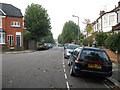
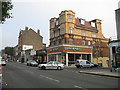
Photos of N12 8LQ


Area Information
N12 8LQ is a small, tightly knit residential postcode in England, home to 2219 people. It is a compact area where daily life is shaped by its proximity to transport hubs and local amenities. The community here is predominantly composed of adults aged 30-64, with a median age of 47, suggesting a mature population that may include professionals and families. The area’s housing stock is largely made up of flats, reflecting a mix of owner-occupied and rental properties. While the postcode itself is small, it is well-connected to surrounding districts, offering residents access to a range of services. The presence of nearby schools, retail outlets, and public transport options indicates a practical, functional lifestyle. However, the area’s character is defined by its residential focus, with limited natural or historical features. For those seeking a quiet, community-oriented environment with practical infrastructure, N12 8LQ provides a straightforward, no-frills setting.
- Area Type
- Postcode
- Area Size
- Not available
- Population
- 2219
- Population Density
- 13432 people/km²
The property market in N12 8LQ is characterised by a 41% home ownership rate, with flats being the primary accommodation type. This suggests a rental market that dominates over owner-occupation, which is common in areas with limited housing diversity. The prevalence of flats may appeal to those seeking lower-maintenance living or proximity to urban centres. However, the small size of the postcode means the housing stock is limited, and buyers may need to look beyond the immediate area for more options. The flat-centric market could also indicate a focus on shared spaces or multi-unit developments. For those considering purchase, the area’s compactness and reliance on rental properties may affect long-term investment potential.
House Prices in N12 8LQ
No properties found in this postcode.
Energy Efficiency in N12 8LQ
Life in N12 8LQ is supported by a range of amenities within practical reach. The area is surrounded by five retail outlets, including major chains like Tesco, Aldi, and Sainsburys, ensuring easy access to groceries and daily essentials. Public transport hubs such as Woodside Park Metro Station and New Southgate Rail Station provide seamless connections to London and beyond. For leisure, ferry services to Camden Lock and London Zoo offer alternative routes for travel or sightseeing. The density of retail, transport, and ferry options suggests a practical, service-oriented lifestyle. While the area lacks large parks or cultural venues, its proximity to transport and shops makes it convenient for those prioritising accessibility over expansive green spaces.
Amenities
Schools
The nearest school to N12 8LQ is Northside Primary School, which is rated 'good' by Ofsted. This provides a reliable option for families with young children, though no secondary schools are listed in the data. The presence of a primary school with a strong rating is a key factor for families prioritising education. However, the absence of secondary schools within the area means that students may need to commute to nearby districts. The single school option highlights the importance of checking additional educational facilities in surrounding areas. For parents, the quality of Northside Primary School offers a positive aspect of life in N12 8LQ.
| Rank | School | Type | Entry gender | Ages |
|---|
Explore more schools in this area
Go to Schools tabDemographics
The population of N12 8LQ is 2219, with a median age of 47. The most common age group is adults aged 30-64, making up the majority of residents. Home ownership here stands at 41%, meaning that 59% of households are likely to be renters. This suggests a mix of long-term residents and those in transient housing situations. The accommodation type is predominantly flats, which aligns with the area’s compact nature. The predominant ethnic group is White, though no specific diversity statistics are provided. The absence of detailed data on deprivation or household composition means that the quality of life can only be inferred from the available metrics. The age profile indicates a stable, middle-aged population, which may influence local services and amenities.
Household Size
Accommodation Type
Tenure
Ethnic Group
Religion
Household Composition
Age
Household Deprivation
NS-SEC
Explore more demographic insights in this area
Go to Demographics tabPlanning
Planning Constraints
- Flood RiskPremium
- Ramsar Wetland SitesPremium
- Area of Outstanding Natural BeautyPremium
- Protected Nature ReservePremium
- Protected WoodlandPremium