Area Overview for N12 8LF
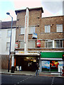
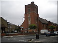
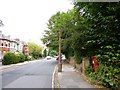
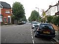
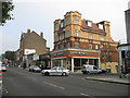
Photos of N12 8LF


Area Information
Living in N12 8LF means inhabiting a small, tightly knit residential cluster in north London. With a population of 2,219, the area is compact but well-served by nearby amenities, making it practical for daily life. The community is predominantly composed of adults aged 30–64, reflecting a mature demographic. Flats are the primary form of accommodation, with 41% of homes owned outright. This suggests a mix of long-term residents and renters, though the small size of the area means property choices are limited. The postcode’s proximity to transport hubs and retail centres adds convenience, while broadband and mobile connectivity scores of 89 and 85 respectively ensure reliable digital access. For those prioritising ease of movement, N12 8LF offers a balance of local services and connections to wider London networks. However, the area’s character is defined by its quiet residential nature, with little in the way of large-scale development or landmarks. It is a place for those seeking a manageable, functional living environment without the sprawl of larger suburbs.
- Area Type
- Postcode
- Area Size
- Not available
- Population
- 2219
- Population Density
- 13432 people/km²
The property market in N12 8LF is characterised by a high concentration of flats, with 41% of homes owned outright. This suggests a rental market that dominates, as the low home ownership rate indicates many residents are likely to be tenants rather than homeowners. The small size of the area means the housing stock is limited, with little scope for new developments or varied property types. For buyers, this presents challenges: the limited number of owner-occupied homes may make it difficult to find a property for purchase, and the predominance of flats could restrict options for those seeking larger or more traditional housing. The area’s compact nature also means that property values and availability are closely tied to nearby zones, where more diverse housing might be found. Prospective buyers should consider the long-term viability of purchasing in a market where rental demand may outstrip supply.
House Prices in N12 8LF
No properties found in this postcode.
Energy Efficiency in N12 8LF
The lifestyle in N12 8LF is shaped by its proximity to a range of amenities. Nearby shops include Tesco North, Aldi North, and Waitrose Finchley, offering convenience for daily errands. The area’s transport links provide access to leisure opportunities, with ferry stops near London Zoo and Camden Lock adding cultural and recreational value. Metro and rail stations like Woodside Park and New Barnet Station make it easy to reach larger retail parks, parks, and entertainment districts. While the area itself is residential, its position near major transport routes means residents can enjoy both local simplicity and the vibrancy of nearby hubs. The mix of retail, transport, and leisure options ensures a balanced lifestyle, though the lack of detailed data on parks or recreational spaces means their quality remains unspecified.
Amenities
Schools
The nearest school to N12 8LF is Northside Primary School, which holds a good Ofsted rating. As a primary school, it serves the local community’s younger population, though no secondary schools are listed in the data. The presence of a single primary school suggests that families may need to look further afield for secondary education, which could impact decisions about where to live. The good rating indicates a satisfactory standard of teaching and facilities, but the lack of additional schools means there is no redundancy or choice in the local education system. For parents prioritising proximity to schools, Northside Primary offers a reliable option, but further research into secondary schooling options would be necessary for families with older children.
| Rank | School | Type | Entry gender | Ages |
|---|
Explore more schools in this area
Go to Schools tabDemographics
The community in N12 8LF is predominantly made up of adults aged 30–64, with a median age of 47. This suggests a population that is largely settled, with fewer young families or elderly residents compared to other areas. Home ownership stands at 41%, which is lower than the national average, indicating a higher proportion of rental properties. The accommodation type is almost exclusively flats, reflecting a lack of larger homes or detached housing. The predominant ethnic group is White, though no specific data on diversity or deprivation is provided. For those considering the area, the age profile and ownership levels suggest a stable, low-turnover environment. The absence of significant deprivation data means it is difficult to assess broader quality-of-life factors, but the demographic stability implies a consistent local economy and social fabric.
Household Size
Accommodation Type
Tenure
Ethnic Group
Religion
Household Composition
Age
Household Deprivation
NS-SEC
Explore more demographic insights in this area
Go to Demographics tabPlanning
Planning Constraints
- Flood RiskPremium
- Ramsar Wetland SitesPremium
- Area of Outstanding Natural BeautyPremium
- Protected Nature ReservePremium
- Protected WoodlandPremium