Area Overview for N12 8LB
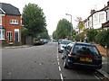
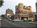
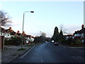
Photos of N12 8LB


Area Information
Living in N12 8LB means being part of a small, tightly knit residential cluster in north London, home to 2,219 people. The area is defined by its compact nature, with a population skewed toward adults aged 30–64, reflecting a community of professionals and families. Daily life here is shaped by proximity to transport hubs and retail centres, with five major supermarkets within reach, including Tesco North and Sainsburys North. The median age of 47 suggests a mature demographic, with a strong presence of owner-occupied homes—though only 41% of properties are owned outright, indicating a rental market. The area’s appeal lies in its balance of convenience and accessibility, with multiple metro and rail stations within walking distance, including Woodside Park and New Southgate. For families, the nearby Northside Primary School, rated ‘good’ by Ofsted, offers a solid foundation for education. While N12 8LB lacks natural landscapes, its urban connectivity and practical amenities make it a viable choice for those prioritising ease of movement and proximity to services.
- Area Type
- Postcode
- Area Size
- Not available
- Population
- 2219
- Population Density
- 13432 people/km²
The property market in N12 8LB is characterised by a high proportion of rental units, with only 41% of homes owned outright. This suggests a market that is more oriented toward tenants than investors seeking long-term ownership. The accommodation type is predominantly flats, which may reflect the area’s compact nature and the demand for smaller, manageable properties. For buyers, this means a limited pool of owner-occupied homes, potentially making the area more competitive for those seeking to purchase. The small size of N12 8LB also means that the immediate surroundings are critical to consider, as nearby areas may offer similar housing stock. Given the high proportion of flats, buyers should assess whether this aligns with their preferences for property type and long-term value. The rental market’s dominance may also influence local property prices and availability.
House Prices in N12 8LB
No properties found in this postcode.
Energy Efficiency in N12 8LB
Daily life in N12 8LB is enriched by a range of amenities within easy reach. The area is served by five major supermarkets, including Tesco North and Aldi North, ensuring convenience for shopping and daily essentials. Transport links are extensive, with multiple metro, rail, and ferry options enabling swift travel to nearby destinations. The presence of ferry stops like Camden Lock Waterbus and London Zoo Waterbus Stop offers opportunities for leisure activities, though these are more recreational than commuter-focused. While the data does not mention parks or green spaces, the area’s focus on retail and transport suggests a lifestyle prioritising accessibility over natural landscapes. The combination of shops, transport, and connectivity creates a practical environment for those valuing ease of movement and proximity to services.
Amenities
Schools
The nearest school to N12 8LB is Northside Primary School, a primary institution with a ‘good’ Ofsted rating. This provides families with a reliable educational option for younger children. However, the data does not include secondary schools or further education institutions, meaning parents may need to look beyond the immediate area for comprehensive schooling. The presence of a well-rated primary school is a positive factor for families prioritising education, though the absence of secondary options could be a consideration for those requiring a full range of school facilities. The school’s rating suggests a focus on quality teaching and student outcomes, which may appeal to parents seeking a stable foundation for their children’s education.
| Rank | School | Type | Entry gender | Ages |
|---|
Explore more schools in this area
Go to Schools tabDemographics
N12 8LB’s population of 2,219 is predominantly composed of adults aged 30–64, with a median age of 47. This suggests a community of established professionals and families, rather than a younger, student-driven demographic. Home ownership stands at 41%, meaning nearly 60% of residents rent their homes, reflecting a market skewed toward rental properties. The area’s accommodation is largely flats, which aligns with the higher proportion of rental units. The predominant ethnic group is White, though specific diversity metrics are not provided. The age profile indicates a mature population, which may influence local services and amenities. With no data on deprivation levels, it is unclear how economic factors shape quality of life, but the presence of multiple retail and transport options suggests a reasonably well-served community.
Household Size
Accommodation Type
Tenure
Ethnic Group
Religion
Household Composition
Age
Household Deprivation
NS-SEC
Explore more demographic insights in this area
Go to Demographics tabPlanning
Planning Constraints
- Flood RiskPremium
- Ramsar Wetland SitesPremium
- Area of Outstanding Natural BeautyPremium
- Protected Nature ReservePremium
- Protected WoodlandPremium