Area Overview for N12 8BP
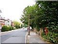
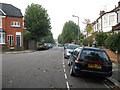
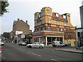
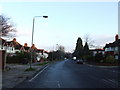
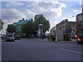
Photos of N12 8BP


Area Information
Living in N12 8BP means being part of a small, tightly knit residential cluster in north London. With a population of 1,667, the area is compact but well-served by essential services and transport links. The community is predominantly composed of adults aged 30-64, reflecting a mature demographic with a strong presence of owner-occupied homes. Flats dominate the housing stock, making this a practical choice for those seeking urban living without the need for a larger property. The area’s proximity to major transport hubs, including multiple metro and rail stations, ensures easy access to central London and beyond. For families, the outstanding-rated St Michael’s Catholic Grammar School provides a high-quality primary education within reach. Daily life here balances convenience with a quieter, residential atmosphere, where digital connectivity is robust and safety is a priority. N12 8BP is ideal for those who value accessibility without compromising on a sense of community.
- Area Type
- Postcode
- Area Size
- Not available
- Population
- 1667
- Population Density
- 9608 people/km²
The property market in N12 8BP is characterised by a high proportion of owner-occupied flats, with 62% of homes owned by residents. This suggests a stable market where long-term residency is common, rather than a high-turnover rental scene. The dominance of flats reflects the area’s small size and urban setting, making it a practical choice for those prioritising convenience over larger properties. While specific price data is not provided, the high home ownership rate implies a degree of affordability or long-term investment appeal. Buyers should consider the limited housing stock and the focus on flats when exploring the area. The absence of major planning constraints, such as protected woodlands or areas of outstanding natural beauty, means development is unlikely to disrupt the existing residential character. For those seeking a compact, well-connected home, N12 8BP offers a straightforward, owner-occupied market with clear advantages for commuters and families.
House Prices in N12 8BP
No properties found in this postcode.
Energy Efficiency in N12 8BP
Residents of N12 8BP enjoy a range of amenities within easy reach. The area is served by five retail outlets, including major supermarkets like Tesco North and Sainsburys North, ensuring daily essentials are always accessible. Transport links are extensive, with metro, rail, and ferry options providing seamless access to nearby attractions and employment hubs. The presence of multiple stations, such as West Finchley and Oakleigh Park, enhances mobility for both work and leisure. For leisure, the nearby London Zoo Waterbus Stop offers a unique way to explore the city. The compact nature of the area means that amenities are concentrated, reducing the need for long journeys. This mix of retail, transport, and recreational options creates a lifestyle that balances convenience with urban vibrancy, making N12 8BP ideal for those who value accessibility and practicality.
Amenities
Schools
The nearest school to N12 8BP is St Michael’s Catholic Grammar School, a primary school with an Ofsted rating of outstanding. This rating highlights the school’s commitment to high standards in education, making it a strong draw for families. The presence of a primary school within the area ensures that children have access to quality education without the need for long commutes. While no secondary schools are listed, the proximity to major transport links suggests that parents can easily access further education options in nearby areas. The single school listed reflects the area’s small size but ensures that educational needs are met for younger children. For families prioritising academic excellence, St Michael’s Catholic Grammar School provides a reliable foundation for early learning.
| Rank | School | Type | Entry gender | Ages |
|---|
Explore more schools in this area
Go to Schools tabDemographics
The population of N12 8BP is 1,667, with a median age of 47. The majority of residents fall within the 30-64 age range, indicating a stable, established community. Home ownership rates stand at 62%, suggesting a significant proportion of residents are long-term residents rather than renters. The primary accommodation type is flats, which aligns with the area’s compact nature and urban layout. The predominant ethnic group is White, though no specific data on diversity or deprivation is provided. The age profile and ownership figures suggest a community focused on stability, with fewer young families or transient populations. This demographic profile contributes to a low-crime environment, as evidenced by the area’s safety score of 77. The mix of adults and owner-occupied properties reinforces a mature, low-maintenance lifestyle that appeals to professionals and retirees alike.
Household Size
Accommodation Type
Tenure
Ethnic Group
Religion
Household Composition
Age
Household Deprivation
NS-SEC
Explore more demographic insights in this area
Go to Demographics tabPlanning
Planning Constraints
- Flood RiskPremium
- Ramsar Wetland SitesPremium
- Area of Outstanding Natural BeautyPremium
- Protected Nature ReservePremium
- Protected WoodlandPremium