Area Overview for N12 7NJ
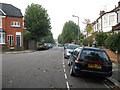
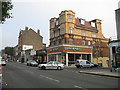
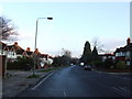
Photos of N12 7NJ


Area Information
N12 7NJ is a compact postcode area in north London, spanning just 5,603 square metres and home to 2,219 residents. Its high population density—396,017 people per square kilometre—reflects a tightly packed residential cluster, typical of inner London’s urban fabric. This area is defined by its proximity to transport hubs and retail corridors, making it a practical choice for commuters. Daily life here is shaped by the mix of local shops, public transport, and nearby green spaces. The area’s small size means residents are close to amenities, though the density can create a sense of proximity that some may find either comforting or overwhelming. With a median age of 47, the community is skewed toward adults in their 30s to 60s, suggesting a balance between families and professionals. The presence of Northside Primary School, rated good by Ofsted, adds to the appeal for families seeking quality education. However, the area’s compact nature means it is best suited for those prioritising convenience over expansive living space.
- Area Type
- Postcode
- Area Size
- 5603 m²
- Population
- 2219
- Population Density
- 13432 people/km²
N12 7NJ’s property market is characterised by a 41% home ownership rate, indicating that the majority of residents are renters. The accommodation type is predominantly flats, which aligns with the area’s high population density and small footprint. This suggests a housing stock focused on compact, multi-unit developments rather than detached or semi-detached homes. For buyers, this means the area is unlikely to offer traditional family homes, instead catering to those seeking smaller, urban living spaces. The limited area size and high density may also mean competition for available properties, particularly in a rental-dominated market. Prospective buyers should consider whether the flat-based stock meets their needs, as the area’s small size and proximity to transport links may appeal more to commuters or those prioritising convenience over space.
House Prices in N12 7NJ
No properties found in this postcode.
Energy Efficiency in N12 7NJ
N12 7NJ offers a range of amenities within practical reach, including retail outlets like Aldi North, Tesco North, and Waitrose Finchley. These shops provide convenience for daily shopping, while the nearby metro and rail stations—Woodside Park, West Finchley, and Finchley Central—ensure easy access to broader urban centres. Ferry services such as the Camden Lock Waterbus add a unique dimension to local transport, connecting residents to attractions like London Zoo. The area’s compact nature means amenities are clustered closely, reducing travel time for essentials. However, the absence of specific parks or leisure facilities in the data suggests that residents may need to venture slightly beyond the postcode for green spaces or recreational activities. The mix of retail, transport, and water-based connectivity creates a functional lifestyle, though the area’s small size may limit options for those seeking expansive leisure opportunities.
Amenities
Schools
The nearest school to N12 7NJ is Northside Primary School, which serves the local community with a good Ofsted rating. This primary school is a key asset for families in the area, offering a reliable educational foundation for younger children. However, the data does not list secondary schools or other educational institutions, meaning families may need to look beyond the immediate postcode for comprehensive schooling. The presence of a well-rated primary school is a strong point for N12 7NJ, but parents should investigate further to ensure secondary education options are accessible. The school’s rating suggests a focus on quality teaching and facilities, though the absence of additional schools highlights a potential limitation for those requiring a full range of educational services.
| Rank | School | Type | Entry gender | Ages |
|---|
Explore more schools in this area
Go to Schools tabDemographics
The population of N12 7NJ is predominantly adults aged 30–64, with a median age of 47. This suggests a community of established professionals and families, though the 41% home ownership rate indicates that a majority of residents rent. The accommodation type is primarily flats, reflecting the area’s high density and likely development as part of larger residential schemes. The predominant ethnic group is White, though no specific data on diversity beyond this is provided. The age profile and ownership statistics suggest a mature, stable community, but the lower home ownership rate may imply a rental market with limited long-term investment opportunities. The absence of specific data on deprivation means the area’s socioeconomic challenges cannot be assessed, but the high population density and compact layout may influence daily life and access to services.
Household Size
Accommodation Type
Tenure
Ethnic Group
Religion
Household Composition
Age
Household Deprivation
NS-SEC
Explore more demographic insights in this area
Go to Demographics tabPlanning
Planning Constraints
- Flood RiskPremium
- Ramsar Wetland SitesPremium
- Area of Outstanding Natural BeautyPremium
- Protected Nature ReservePremium
- Protected WoodlandPremium