Area Overview for N12 7NH
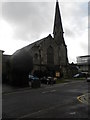
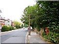
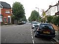
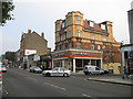
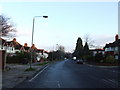
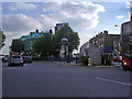
Photos of N12 7NH

Area Information
Living in N12 7NH means inhabiting a tightly packed residential cluster in north London, where 2,219 people reside across just 2,507 square metres. This density creates a compact, walkable environment, though space is clearly limited. The area’s character is shaped by its demographics: a median age of 47, with most residents aged 30–64, suggesting a stable, mature community. Flats dominate the housing stock, reflecting a mix of owner-occupied and rental properties. While the area lacks natural landscapes or protected sites, its proximity to transport hubs and retail centres offers practical convenience. Nearby, Northside Primary School provides a good-rated education for younger families, and multiple metro, rail, and ferry stops ensure easy access to London’s broader network. However, the high population density and limited space mean the area feels more like a tightly woven neighbourhood than a sprawling suburb. For those prioritising connectivity and proximity to urban amenities, N12 7NH offers a compact, functional base, though its small size may feel restrictive for those seeking more open living.
- Area Type
- Postcode
- Area Size
- 2507 m²
- Population
- 2219
- Population Density
- 13432 people/km²
The property market in N12 7NH is defined by its high density and limited space. With 41% of homes owner-occupied, the area is not dominated by a rental market but remains a mix of both. Flats are the primary accommodation type, which reflects the constraints of the small area and the need for efficient use of space. This means properties are likely to be smaller, with fewer private gardens or outdoor areas. For buyers, the compact nature of the area means there is little scope for larger homes or renovations that expand living space. The small size of N12 7NH also means the housing stock is limited, with few new developments likely. Prospective buyers should consider the practicality of flat living and the potential for shared walls or communal facilities. Given the high population density, the area is more suited to those prioritising proximity to transport and amenities over expansive living space.
House Prices in N12 7NH
Showing 1 properties
| Address | Type | Beds | Baths | Last Sale Price | Last Sale Date | |
|---|---|---|---|---|---|---|
| St Michaels Convent, Nether Street, Ballards Lane To Dollis Road, London, N12 7NH | commercial | - | - | £620,000 | Mar 2020 |
Energy Efficiency in N12 7NH
Daily life in N12 7NH is shaped by its proximity to retail, transport, and leisure options. The area is within walking distance of five notable retailers, including Aldi North, Tesco North, and Waitrose Finchley, providing access to groceries, household goods, and dining. Transport hubs like Woodside Park Station and Finchley Central Station ensure easy access to London’s wider network, while rail services connect to New Southgate and New Barnet. Two ferry stops, Camden Lock Waterbus and London Zoo Waterbus Stop, offer alternative routes, though their frequency and destinations are unspecified. The compact nature of the area means amenities are close but limited in variety, with a focus on practicality over diversity. For residents, this creates a functional, convenience-driven lifestyle, though those seeking more extensive leisure options may need to venture further afield.
Amenities
Schools
The nearest school to N12 7NH is Northside Primary School, which provides education for younger children and holds an Ofsted rating of ‘good’. This school is the only one listed in the data, meaning families with children under 11 have access to a single primary education option. The absence of secondary schools in the immediate area suggests that older students may need to travel to nearby districts for secondary education. The ‘good’ rating indicates a satisfactory standard of teaching and facilities, though no further details on curriculum or performance are provided. For families prioritising proximity to schools, Northside Primary offers a reliable option, but the lack of additional educational institutions may limit choices for those requiring specialist provisions or a broader range of school types.
| Rank | School | Type | Entry gender | Ages |
|---|
Explore more schools in this area
Go to Schools tabDemographics
N12 7NH’s population of 2,219 is concentrated in a space of just 2,507 square metres, resulting in a density of 885,133 people per square kilometre. This makes it one of the most densely populated areas in England. The median age of 47 indicates a community skewed towards adults, with the 30–64 age range making up the majority. Home ownership here is relatively low at 41%, suggesting a significant proportion of residents rent their homes. Flats are the predominant accommodation type, which aligns with the area’s limited space and high density. The predominant ethnic group is White, though no specific breakdown of diversity is provided. The high population density may influence daily life, with limited private outdoor space and a focus on shared communal areas. For buyers, this means properties are likely smaller and more compact, with little scope for expansion. The age profile suggests a stable, mature population, though the lack of younger residents may affect local amenities and services tailored to families.
Household Size
Accommodation Type
Tenure
Ethnic Group
Religion
Household Composition
Age
Household Deprivation
NS-SEC
Explore more demographic insights in this area
Go to Demographics tabPlanning
Planning Constraints
- Flood RiskPremium
- Ramsar Wetland SitesPremium
- Area of Outstanding Natural BeautyPremium
- Protected Nature ReservePremium
- Protected WoodlandPremium