Area Overview for N12 7HN
Photos of N12 7HN


Area Information
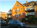
Living in N12 7HN means inhabiting a small, tightly knit residential cluster in north London, where the population of 1,538 residents reflects a quiet, established community. This area is defined by its proximity to key transport hubs and a mix of local amenities that cater to daily needs. With a median age of 47, the neighbourhood is predominantly home to adults aged 30–64, suggesting a stable demographic of families and professionals. The area’s low flood risk and below-average crime rates—scoring 87 out of 100 for safety—make it an attractive option for those prioritising security and reliability. While N12 7HN is not a sprawling suburb, its compact nature ensures residents are within easy reach of shops, public transport, and green spaces. The absence of environmental constraints like protected woodlands or AONB designations means development is not restricted, offering flexibility for future growth. For those seeking a balanced blend of convenience and tranquillity, this postcode provides a foundation for a practical, low-maintenance lifestyle.
- Area Type
- Postcode
- Area Size
- Not available
- Population
- 1538
- Population Density
- 2999 people/km²
The property market in N12 7HN is dominated by owner-occupied homes, with 83% of properties in private hands. This high rate of home ownership suggests a stable, long-term resident population rather than a transient rental market. The accommodation type is predominantly houses, which is unusual in urban areas and may indicate a preference for larger, family-oriented living spaces. Given the small size of the postcode area, the housing stock is likely limited, making it a niche market for buyers seeking a specific type of property. The absence of flats or apartments means that the area may not appeal to those prioritising high-density living or investment in rental properties. For those considering purchase, the focus should be on individual homes rather than broader development opportunities, as the area’s compact nature restricts expansion. Buyers should also consider the proximity to transport links and amenities, which enhance the area’s practicality despite its small footprint.
House Prices in N12 7HN
No properties found in this postcode.
Energy Efficiency in N12 7HN
Residents of N12 7HN have access to a range of local amenities within practical reach. The area is served by five retail outlets, including Sainsburys North, Tesco North, and Waitrose Finchley, ensuring everyday shopping needs are met. For transport, five metro stations—Woodside Park, West Finchley, and Totteridge & Whetstone—offer frequent services, while three rail stations—Oakleigh Park, New Barnet, and New Southgate—connect to broader networks. Water-based transport is also available via Camden Lock Waterbus and London Zoo Waterbus Stop, adding variety to commuting options. Though the area is small, its proximity to these amenities suggests a well-served community. The presence of major retailers and transport hubs implies a lifestyle that balances convenience with the potential for quieter, residential living. While there are no specific parks or leisure facilities listed, the lack of environmental constraints means residents are unlikely to face restrictions on outdoor activities.
Amenities
Schools
| Rank | School | Type | Entry gender | Ages |
|---|
Explore more schools in this area
Go to Schools tabDemographics
The community in N12 7HN is characterised by a median age of 47, with the majority of residents falling within the 30–64 age range. This suggests a population skewed towards middle-aged adults, likely including families and professionals. Home ownership is high, with 83% of properties occupied by their owners, indicating a stable, long-term resident base. The area is primarily composed of houses, rather than flats or apartments, which aligns with the demographic’s preference for family-friendly housing. The predominant ethnic group is White, though no further breakdown of diversity is provided. The absence of specific data on deprivation means the quality of life cannot be assessed in that context, but the low crime score and lack of environmental restrictions suggest a generally secure and accessible environment. This profile paints a picture of a mature, settled community with little turnover, where residents are likely to have established roots.
Household Size
Accommodation Type
Tenure
Ethnic Group
Religion
Household Composition
Age
Household Deprivation
NS-SEC
Explore more demographic insights in this area
Go to Demographics tabPlanning
Planning Constraints
- Flood RiskPremium
- Ramsar Wetland SitesPremium
- Area of Outstanding Natural BeautyPremium
- Protected Nature ReservePremium
- Protected WoodlandPremium