Area Overview for N12 7EP
Photos of N12 7EP

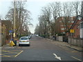
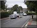

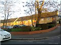
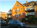
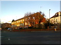
82 photos from this area
Area Information
Key information about the N12 7EP including its size, population, and administrative classification.
- Area Type
- Postcode
- Area Size
- 1.6 hectares
- Population
- 1740
- Population Density
- 5255 people/km²
House Prices in N12 7EP
11
Properties
£794,500
Average Sold Price
£250,000
Lowest Price
£1,540,000
Highest Price
Showing 11 properties
| Address | Type | Beds | Baths | Last Sale Price | Last Sale Date | |
|---|---|---|---|---|---|---|
| 21 Twineham Green, North Finchley, London, N12 7EP | Semi-detached | 4 | 2 | £925,000 | May 2019 | |
| 13 Twineham Green, North Finchley, London, N12 7EP | house | 4 | 2 | £1,275,000 | Aug 2018 | |
| 19 Twineham Green, North Finchley, London, N12 7EP | Detached | 5 | 4 | £1,540,000 | Aug 2018 | |
| 16 Twineham Green, North Finchley, London, N12 7EP | house | - | - | £800,000 | Mar 2016 | |
| 17 Twineham Green, North Finchley, London, N12 7EP | house | - | - | £800,000 | Oct 2012 | |
| 14 Twineham Green, North Finchley, London, N12 7EP | house | 4 | - | £795,000 | Jul 2010 | |
| 12 Twineham Green, North Finchley, London, N12 7EP | house | - | - | £615,000 | Aug 2005 | |
| 18 Twineham Green, North Finchley, London, N12 7EP | Detached | 5 | 2 | £670,000 | Apr 2005 | |
| 20 Twineham Green, North Finchley, London, N12 7EP | Detached | - | - | £275,000 | Feb 1999 | |
| 15 Twineham Green, North Finchley, London, N12 7EP | Semi-detached | - | - | £250,000 | Oct 1998 |
Page 1 of 2
Energy Efficiency in N12 7EP
Amenities
Schools
| Rank | School | Type | Entry gender | Ages |
|---|
Explore more schools in this area
Go to Schools tabDemographics
Household Size
Family (3-5 people)
most common
Accommodation Type
Flats
most common
Tenure
58
majority
Ethnic Group
White
most common
Religion
N/A
most common
Household Composition
N/A
most common
Age
47
median
Adults (30-64 years)
most common
Household Deprivation
N/A
with no deprivation
NS-SEC
49
in Lower managerial occupations
Explore more demographic insights in this area
Go to Demographics tabPlanning
Planning Constraints
- Flood RiskPremium
- Ramsar Wetland SitesPremium
- Area of Outstanding Natural BeautyPremium
- Protected Nature ReservePremium
- Protected WoodlandPremium