Area Overview for N12 7EF
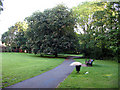
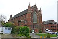
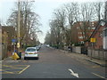
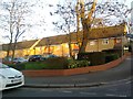
Photos of N12 7EF


Area Information
Living in N12 7EF means being part of a compact, residential cluster in north London with a population of 1740. This area is defined by its proximity to key transport links and a mix of retail and leisure options. The community is predominantly composed of adults aged 30-64, reflecting a mature demographic with established routines. Daily life here is shaped by the availability of nearby amenities, from supermarkets to rail stations, which make commuting and shopping efficient. The area’s small size means it is tightly knit, with residents likely to know their neighbours. While it lacks large-scale natural features, its accessibility to urban infrastructure ensures a balance between convenience and quiet living. For those prioritising practicality over sprawling landscapes, N12 7EF offers a straightforward, no-frills environment. The low flood risk and minimal planning constraints further contribute to a stable living situation. Whether you’re working from home or heading into the city, the connectivity here supports both lifestyles.
- Area Type
- Postcode
- Area Size
- Not available
- Population
- 1740
- Population Density
- 5255 people/km²
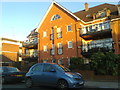
The property market in N12 7EF is characterised by a high proportion of flats, reflecting the area’s compact nature and urban setting. With 58% of homes owner-occupied, this suggests a mix of long-term residents and investors, though the small population means the market is likely limited in scale. The prevalence of flats indicates that the housing stock is not suited to larger families or those seeking detached homes. Buyers should consider that the area’s size restricts the availability of diverse property types. The lack of planning constraints, such as protected woodlands or AONBs, may make it easier to develop or renovate properties. However, the small population and limited housing stock could mean competition for available units. For those prioritising convenience over space, N12 7EF’s proximity to transport and retail hubs may outweigh the limitations of its housing options.
House Prices in N12 7EF
No properties found in this postcode.
Energy Efficiency in N12 7EF
Life in N12 7EF is convenient, with a range of amenities within walking or short-vehicle distance. Retail options include Sainsburys North, Tesco North, and Aldi North, ensuring access to groceries and household essentials. The area’s transport links are extensive, with metro stations like Woodside Park and West Finchley offering quick access to London’s transport network. For leisure, the nearby London Zoo Waterbus Stop and Camden Lock Waterbus provide alternative ways to explore the city. Parks and open spaces are not explicitly mentioned, but the absence of protected natural areas suggests a focus on urban living. The presence of multiple rail and metro stations also means residents can easily reach cultural hubs, shopping centres, or recreational areas. This blend of retail, transport, and connectivity supports a lifestyle that prioritises efficiency and accessibility over sprawling green spaces.
Amenities
Schools
| Rank | School | Type | Entry gender | Ages |
|---|
Explore more schools in this area
Go to Schools tabDemographics
The community in N12 7EF is predominantly made up of adults aged 30-64, with a median age of 47. This suggests a population that is largely settled, with fewer young families or retirees. Home ownership stands at 58%, indicating a mix of owner-occupied properties and rental units. The accommodation type is primarily flats, which is typical for urban areas with limited space. The predominant ethnic group is White, though specific data on diversity beyond this is not provided. The age profile and ownership figures suggest a stable, middle-aged population with long-term residency. With no data on deprivation levels, it is unclear how this affects access to services, but the presence of multiple retail and transport options implies reasonable local provision. The demographic composition aligns with a community that values proximity to urban amenities over expansive housing.
Household Size
Accommodation Type
Tenure
Ethnic Group
Religion
Household Composition
Age
Household Deprivation
NS-SEC
Explore more demographic insights in this area
Go to Demographics tabPlanning
Planning Constraints
- Flood RiskPremium
- Ramsar Wetland SitesPremium
- Area of Outstanding Natural BeautyPremium
- Protected Nature ReservePremium
- Protected WoodlandPremium