Area Overview for N12 7BL
Photos of N12 7BL

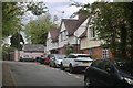
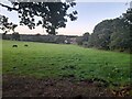

36 photos from this area
Area Information
Key information about the N12 7BL including its size, population, and administrative classification.
- Area Type
- Postcode
- Area Size
- 1.2 hectares
- Population
- 1476
- Population Density
- 5361 people/km²
House Prices in N12 7BL
11
Properties
£615,250
Average Sold Price
£184,500
Lowest Price
£1,045,000
Highest Price
Showing 11 properties
| Address | Type | Beds | Baths | Last Sale Price | Last Sale Date | |
|---|---|---|---|---|---|---|
| 71 Lullington Garth, North Finchley, London, N12 7BL | Terraced | 3 | 1 | £805,000 | Mar 2025 | |
| 83 Lullington Garth, North Finchley, London, N12 7BL | Semi-detached | 4 | 2 | £1,045,000 | Aug 2023 | |
| 85 Lullington Garth, North Finchley, London, N12 7BL | Semi-detached | 3 | 1 | £872,500 | Jun 2018 | |
| 81 Lullington Garth, North Finchley, London, N12 7BL | Semi-detached | 4 | 2 | £617,500 | Mar 2013 | |
| 73 Lullington Garth, North Finchley, London, N12 7BL | Semi-detached | 3 | 1 | £575,000 | Feb 2013 | |
| 69 Lullington Garth, North Finchley, London, N12 7BL | Semi-detached | - | - | £550,000 | Jun 2004 | |
| 79 Lullington Garth, North Finchley, London, N12 7BL | Semi-detached | - | - | £184,500 | Nov 1997 | |
| 87 Lullington Garth, North Finchley, London, N12 7BL | Detached | - | - | £272,500 | Dec 1996 | |
| 75 Lullington Garth, North Finchley, London, N12 7BL | house | - | - | - | - | |
| 67 Lullington Garth, North Finchley, London, N12 7BL | Semi-detached | 3 | 1 | - | - |
Page 1 of 2
Energy Efficiency in N12 7BL
Amenities
Schools
| Rank | School | Type | Entry gender | Ages |
|---|
Explore more schools in this area
Go to Schools tabDemographics
Household Size
Family (3-5 people)
most common
Accommodation Type
Houses
most common
Tenure
78
majority
Ethnic Group
White
most common
Religion
N/A
most common
Household Composition
N/A
most common
Age
47
median
Adults (30-64 years)
most common
Household Deprivation
N/A
with no deprivation
NS-SEC
57
in Lower managerial occupations
Explore more demographic insights in this area
Go to Demographics tabPlanning
Planning Constraints
- Flood RiskPremium
- Ramsar Wetland SitesPremium
- Area of Outstanding Natural BeautyPremium
- Protected Nature ReservePremium
- Protected WoodlandPremium