Area Overview for N12 0NZ
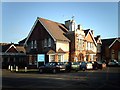
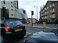
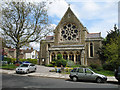
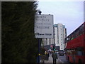
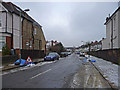
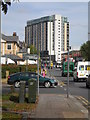
Photos of N12 0NZ


Area Information
Living in N12 0NZ offers a quiet, compact residential experience within a small postcode cluster. With a population of 1,926, the area feels close-knit, though its size means it is more of a niche community than a sprawling suburb. The demographic profile suggests a mature population, with a median age of 47 and the majority of residents aged 30–64. This suggests a stable, established community, likely with families and professionals. The area’s housing stock is predominantly owner-occupied, with 69% of homes owned by residents, and the accommodation type is largely houses, indicating a traditional, family-friendly layout. Proximity to sixth-form colleges like Woodhouse College and the Imperial College London Mathematics School positions N12 0NZ as a hub for older students and families with teenagers. The area’s low flood risk, absence of protected natural sites, and below-average crime rates contribute to a sense of safety and practicality. Residents benefit from strong digital connectivity, with broadband scoring 95 and mobile coverage at 85, ensuring reliable internet for both work and leisure. The mix of retail, transport, and water-based amenities within reach adds to the area’s convenience.
- Area Type
- Postcode
- Area Size
- Not available
- Population
- 1926
- Population Density
- 7069 people/km²
The property market in N12 0NZ is characterised by a high rate of home ownership (69%) and a focus on houses rather than flats or apartments. This indicates a community where long-term residency and family living are prioritised, with properties likely designed for multi-generational use or larger households. The absence of rental market data suggests that the area may not be a hotspot for short-term lets or speculative investment, but rather a place where residents are more likely to own their homes. Given the small size of the postcode and the dominance of houses, the housing stock is limited in scale, which could mean competition for available properties. Buyers should consider the area’s proximity to transport links and schools, which may enhance its appeal for families. However, the lack of specific property price data means the market’s affordability remains unclear. The focus on owner-occupation also implies that the area is less influenced by transient populations, offering a more consistent community feel.
House Prices in N12 0NZ
No properties found in this postcode.
Energy Efficiency in N12 0NZ
The lifestyle in N12 0NZ is shaped by its proximity to a range of retail and transport hubs. Nearby shops include Aldi North, Waitrose Finchley, and Tesco North, providing access to everyday groceries and household essentials. The area’s transport links extend to multiple metro, rail, and ferry services, with stops such as West Finchley Station, Finchley Central Station, and Camden Lock Waterbus offering connections to London’s wider network. These amenities contribute to a convenient, well-connected lifestyle, though the absence of parks or recreational spaces is notable. The presence of waterbus stops near London Zoo and Little Venice suggests opportunities for leisurely travel along the Thames. While the data does not mention dining or cultural venues, the retail and transport options indicate a practical, commuter-friendly environment. The mix of retail, transport, and water-based access points ensures residents can meet daily needs without venturing far, though the area’s character is more functional than vibrant.
Amenities
Schools
The schools nearest to N12 0NZ are all sixth-form colleges, with Woodhouse College and the Imperial College London Mathematics School listed twice in the data. These institutions cater to older students, typically aged 16–18, and are likely to be part of the local education ecosystem for teenagers. The absence of primary or secondary schools in the area suggests that families with younger children may need to look further afield for schooling. However, the presence of two sixth-form colleges could be a draw for those seeking specialist education, particularly the Imperial College London Mathematics School, which may offer advanced STEM-focused programmes. For parents of older students, the proximity to these institutions is a clear advantage, though it does not address the need for younger education options. The lack of diversity in school types means the area’s educational landscape is narrowly focused on post-16 learning, which may influence its appeal to different family demographics.
| Rank | School | Type | Entry gender | Ages |
|---|
Explore more schools in this area
Go to Schools tabDemographics
The community in N12 0NZ is defined by its mature age profile, with a median age of 47 and the majority of residents falling within the 30–64 age range. This suggests a population of working-age adults and older families, likely with established careers and long-term commitments to the area. Home ownership is strong, with 69% of residents owning their homes, reflecting a stable, settled demographic. The accommodation type is primarily houses, which aligns with the age group’s preference for larger, family-oriented properties. The predominant ethnic group is White, though the data does not specify further diversity metrics. The absence of deprivation data in the provided information means the area’s quality of life can be inferred from its safety, connectivity, and amenities. The low crime risk score of 80 (below average) and lack of environmental constraints suggest a secure, low-stress environment. However, the limited data on household types or income levels means broader socioeconomic factors remain unexplored.
Household Size
Accommodation Type
Tenure
Ethnic Group
Religion
Household Composition
Age
Household Deprivation
NS-SEC
Explore more demographic insights in this area
Go to Demographics tabPlanning
Planning Constraints
- Flood RiskPremium
- Ramsar Wetland SitesPremium
- Area of Outstanding Natural BeautyPremium
- Protected Nature ReservePremium
- Protected WoodlandPremium