Area Overview for N11 3WA
Photos of N11 3WA


Area Information
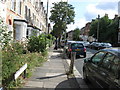
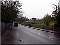
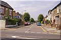
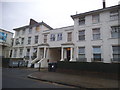
Living in N11 3WA means being part of a small, tightly knit residential cluster in north London. With a population of 2,034, the area is compact yet well-served by transport and amenities. The community is primarily composed of adults aged 30–64, reflecting a mature demographic with a median age of 47. This suggests a stable, established neighbourhood where many residents have lived for years. The area’s housing stock is dominated by flats, a common feature in London’s urban planning. Daily life here balances proximity to transport hubs with a quiet residential atmosphere. While the postcode is small, it connects to broader networks of retail, education, and leisure. The presence of nearby stations and shops ensures convenience without the density of larger urban centres. For those seeking a blend of practicality and accessibility, N11 3WA offers a straightforward, no-frills living experience rooted in functionality.
- Area Type
- Postcode
- Area Size
- Not available
- Population
- 2034
- Population Density
- 8388 people/km²
The property market in N11 3WA is characterised by a high proportion of flats, with 100% of accommodation being flats. This suggests a focus on urban living, typical of London’s inner and outer boroughs. Home ownership sits at 51%, indicating that nearly half of properties are rented, which may reflect the area’s appeal to tenants seeking stable, long-term housing. The small postcode area means the housing stock is limited, with no indication of large-scale development or new builds. Buyers should consider the predominance of flats when assessing availability, as this may limit options for those seeking larger or detached properties. The market likely leans towards rental investors and first-time buyers looking for affordable, manageable units. Proximity to transport links may also influence property values, though specific price data is not provided.
House Prices in N11 3WA
No properties found in this postcode.
Energy Efficiency in N11 3WA
Residents of N11 3WA have access to a range of amenities within practical reach. Retail options include Tesco New, Co-op Friern, and Co-op Woodhouse, providing essential shopping needs. Transport hubs like New Southgate Station and Bowes Park Station connect to broader networks, while ferry stops such as Camden Lock Waterbus offer alternative routes. The area’s proximity to Alexandra Palace Station and Woodside Park Station enhances mobility. For leisure, the nearby London Zoo Waterbus Stop hints at recreational opportunities. The mix of retail, transport, and water-based connectivity supports a functional lifestyle, balancing convenience with the quietude of a smaller postcode.
Amenities
Schools
The nearest school to N11 3WA is Friern Barnet Grammar School, an independent institution. While no Ofsted rating is provided, the presence of an independent school suggests a focus on private education for families in the area. The lack of state schools listed means the educational landscape is limited to this single option, which may influence decisions for families prioritising specific curricula or fee structures. Independent schools often cater to particular educational philosophies, though the data does not specify Friern Barnet Grammar School’s specialisms or performance metrics. For those relying on state education, the area’s school options are sparse, requiring a broader search beyond the immediate postcode.
| Rank | School | Type | Entry gender | Ages |
|---|
Explore more schools in this area
Go to Schools tabDemographics
The population of N11 3WA is predominantly adults aged 30–64, making up the most common age range. This group accounts for the majority of residents, with a median age of 47, indicating a mature, settled community. Home ownership stands at 51%, suggesting a mix of owner-occupied and rental properties. The accommodation type is almost entirely flats, reflecting the area’s urban character. The predominant ethnic group is White, though the data does not specify further diversity metrics. The absence of detailed deprivation data means the quality of life can be inferred from available amenities and services. With a stable age profile and a focus on flats, the area caters to families and professionals seeking manageable living spaces. The community’s structure appears to prioritise practicality over novelty, with little indication of transient populations or high turnover.
Household Size
Accommodation Type
Tenure
Ethnic Group
Religion
Household Composition
Age
Household Deprivation
NS-SEC
Explore more demographic insights in this area
Go to Demographics tabPlanning
Planning Constraints
- Flood RiskPremium
- Ramsar Wetland SitesPremium
- Area of Outstanding Natural BeautyPremium
- Protected Nature ReservePremium
- Protected WoodlandPremium