Area Overview for N11 3LW
Photos of N11 3LW


Area Information
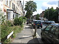
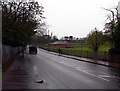
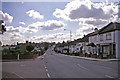
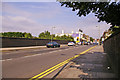
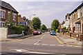
Living in N11 3LW means inhabiting a small, tightly knit residential cluster in north London. With a population of 2,034, the area is compact but well-served by transport links and amenities. The community here is predominantly adults aged 30–64, creating a mature demographic profile. Daily life is shaped by proximity to rail and metro stations, which provide easy access to central London and beyond. The area’s low flood risk and absence of environmental constraints like protected woodlands or wetlands make it a practical choice for those prioritising safety and planning certainty. While the housing stock is limited to flats, the area’s small size fosters a sense of familiarity. Residents benefit from a mix of retail options, including local Co-ops and a Tesco, as well as ferry services to landmarks like London Zoo. N11 3LW is not a sprawling suburb but a focused, functional postcode where convenience and practicality take precedence.
- Area Type
- Postcode
- Area Size
- Not available
- Population
- 2034
- Population Density
- 8388 people/km²
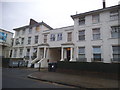
The property market in N11 3LW is characterised by a 51% home ownership rate, with flats forming the majority of the housing stock. This indicates a community where private ownership is common but not universal, with a significant portion of the housing stock likely rented out. The prevalence of flats suggests a focus on smaller, managed developments rather than detached homes, which are rare in this area. Given the small population and limited land area, the housing market is constrained, making it a niche market for buyers seeking specific properties. The compact nature of the postcode means that the immediate surroundings offer little in the way of additional housing options, so buyers must consider the area’s boundaries carefully. The flat-dominated market may appeal to those prioritising ease of maintenance and proximity to transport, though the limited variety of property types could restrict choices.
House Prices in N11 3LW
No properties found in this postcode.
Energy Efficiency in N11 3LW
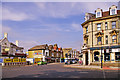
The lifestyle in N11 3LW is shaped by its proximity to retail, transport, and leisure facilities. Local shops include Tesco New and Co-ops at Friern Barnet and Woodhouse, offering everyday essentials within walking distance. The area’s rail and metro stations—New Southgate, Bowes Park, and Alexandra Palace—provide direct links to London’s transport network, making commuting efficient. Ferry services to Camden Lock and London Zoo add a touch of accessibility to cultural and recreational sites. While the area lacks large parks or public spaces, the transport links enable quick access to green spaces elsewhere. The mix of retail and transport options creates a practical, convenient lifestyle, ideal for those who prioritise accessibility over expansive local amenities.
Amenities
Schools
The nearest school to N11 3LW is Friern Barnet Grammar School, an independent institution. This school serves families seeking private education, though the absence of other schools in the data means the area lacks a range of state and independent options. The presence of a single independent school suggests that families in N11 3LW may prioritise private education, potentially requiring commuting to nearby areas for state schooling. The lack of additional schools in the data highlights a potential limitation for those seeking a broader selection of educational institutions. However, the proximity to Friern Barnet Grammar School provides a clear advantage for households valuing independent education.
| Rank | School | Type | Entry gender | Ages |
|---|
Explore more schools in this area
Go to Schools tabDemographics
The community in N11 3LW is defined by its median age of 47, with the most common age range being adults aged 30–64. This suggests a stable, established population with a strong presence of middle-aged residents. Home ownership accounts for 51% of households, with flats being the predominant accommodation type. The area’s demographic profile is largely homogeneous, with White as the predominant ethnic group. The absence of specific data on deprivation means the quality of life cannot be assessed in that context, but the age distribution implies a community with a mix of professionals and families. The low proportion of rental properties suggests a balance between owner-occupied homes and private rentals, though the small population size limits the diversity of household structures. The area’s characteristics reflect a mature, low-density residential cluster with minimal turnover.
Household Size
Accommodation Type
Tenure
Ethnic Group
Religion
Household Composition
Age
Household Deprivation
NS-SEC
Explore more demographic insights in this area
Go to Demographics tabPlanning
Planning Constraints
- Flood RiskPremium
- Ramsar Wetland SitesPremium
- Area of Outstanding Natural BeautyPremium
- Protected Nature ReservePremium
- Protected WoodlandPremium