Area Overview for N11 3HD
Photos of N11 3HD
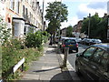

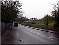
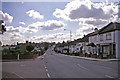
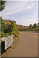
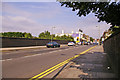

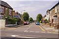


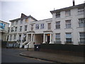

86 photos from this area
Area Information
Key information about the N11 3HD including its size, population, and administrative classification.
- Area Type
- Postcode
- Area Size
- 8440 m²
- Population
- 1955
- Population Density
- 6463 people/km²
House Prices in N11 3HD
42
Properties
£304,495
Average Sold Price
£98,500
Lowest Price
£750,000
Highest Price
Showing 42 properties
| Address | Type | Beds | Baths | Last Sale Price | Last Sale Date | |
|---|---|---|---|---|---|---|
| 56 Holly Park Road, New Southgate, London, N11 3HD | Terraced | 4 | 2 | £750,000 | Apr 2024 | |
| 12 Holly Park Road, New Southgate, London, N11 3HD | house | - | - | £685,000 | Dec 2020 | |
| 14 Holly Park Road, New Southgate, London, N11 3HD | house | - | - | £480,000 | Mar 2020 | |
| 18 Holly Park Road, New Southgate, London, N11 3HD | house | - | - | £495,000 | Apr 2018 | |
| 4 Holly Park Road, New Southgate, London, N11 3HD | house | 3 | 2 | £525,000 | Mar 2016 | |
| 42 Holly Park Road, New Southgate, London, N11 3HD | house | - | - | £375,000 | Nov 2013 | |
| 34A Holly Park Road, New Southgate, London, N11 3HD | Flat | 2 | 1 | £249,950 | Aug 2012 | |
| 2 Holly Park Road, New Southgate, London, N11 3HD | Terraced | 3 | - | £335,000 | Jun 2012 | |
| 20 Holly Park Road, New Southgate, London, N11 3HD | house | 2 | - | £375,000 | Jul 2011 | |
| 54B Holly Park Road, New Southgate, London, N11 3HD | Maisonette | 1 | 1 | £227,500 | Nov 2006 |
Page 1 of 5
Energy Efficiency in N11 3HD
Amenities
Schools
| Rank | School | Type | Entry gender | Ages |
|---|
Explore more schools in this area
Go to Schools tabDemographics
Household Size
Family (3-5 people)
most common
Accommodation Type
Flats
most common
Tenure
55
majority
Ethnic Group
White
most common
Religion
N/A
most common
Household Composition
N/A
most common
Age
47
median
Adults (30-64 years)
most common
Household Deprivation
N/A
with no deprivation
NS-SEC
45
in Lower managerial occupations
Explore more demographic insights in this area
Go to Demographics tabPlanning
Planning Constraints
- Flood RiskPremium
- Ramsar Wetland SitesPremium
- Area of Outstanding Natural BeautyPremium
- Protected Nature ReservePremium
- Protected WoodlandPremium