Area Overview for N11 3BY
Photos of N11 3BY
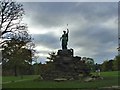

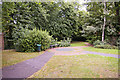
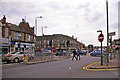
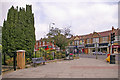

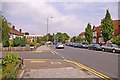


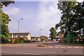


90 photos from this area
Area Information
Key information about the N11 3BY including its size, population, and administrative classification.
- Area Type
- Postcode
- Area Size
- 8156 m²
- Population
- 2034
- Population Density
- 8388 people/km²
House Prices in N11 3BY
34
Properties
£460,136
Average Sold Price
£112,500
Lowest Price
£880,000
Highest Price
Showing 34 properties
| Address | Type | Beds | Baths | Last Sale Price | Last Sale Date | |
|---|---|---|---|---|---|---|
| 19 Hollyfield Avenue, New Southgate, London, N11 3BY | Detached | 5 | 3 | £880,000 | May 2025 | |
| 11 Hollyfield Avenue, New Southgate, London, N11 3BY | house | - | - | £800,000 | Oct 2021 | |
| 25 Hollyfield Avenue, New Southgate, London, N11 3BY | house | - | - | £595,000 | Apr 2020 | |
| 29 Hollyfield Avenue, New Southgate, London, N11 3BY | Terraced | 3 | 1 | £600,000 | Feb 2020 | |
| 27 Hollyfield Avenue, New Southgate, London, N11 3BY | Terraced | 3 | 1 | £595,000 | Oct 2018 | |
| 32 Hollyfield Avenue, New Southgate, London, N11 3BY | Terraced | 4 | - | £642,000 | Oct 2016 | |
| 7 Hollyfield Avenue, New Southgate, London, N11 3BY | Terraced | 3 | 3 | £590,000 | Sep 2016 | |
| 28 Hollyfield Avenue, New Southgate, London, N11 3BY | Terraced | 4 | 2 | £695,000 | Jun 2016 | |
| 26 Hollyfield Avenue, New Southgate, London, N11 3BY | Terraced | 4 | 3 | £699,995 | Mar 2016 | |
| 12 Hollyfield Avenue, New Southgate, London, N11 3BY | Terraced | - | - | £340,000 | Aug 2011 |
Page 1 of 4
Energy Efficiency in N11 3BY
Amenities
Schools
| Rank | School | Type | Entry gender | Ages |
|---|
Explore more schools in this area
Go to Schools tabDemographics
Household Size
Family (3-5 people)
most common
Accommodation Type
Flats
most common
Tenure
51
majority
Ethnic Group
White
most common
Religion
N/A
most common
Household Composition
N/A
most common
Age
47
median
Adults (30-64 years)
most common
Household Deprivation
N/A
with no deprivation
NS-SEC
36
in Lower managerial occupations
Explore more demographic insights in this area
Go to Demographics tabPlanning
Planning Constraints
- Flood RiskPremium
- Ramsar Wetland SitesPremium
- Area of Outstanding Natural BeautyPremium
- Protected Nature ReservePremium
- Protected WoodlandPremium