Area Overview for N11 2TS
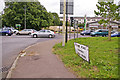
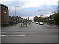
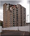
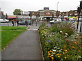
Photos of N11 2TS


Area Information
Living in N11 2TS means being part of a compact, residential cluster in north London with a population of 2,548. This postcode area is defined by its proximity to key transport hubs and a mix of retail and leisure amenities. The community is predominantly composed of adults aged 30–64, reflecting a mature demographic with established lifestyles. Daily life here balances suburban convenience with urban accessibility, with easy access to metro stations, rail links, and nearby shopping centres. While the area is small, it offers practical connectivity to wider London, making it suitable for commuters or those seeking a quieter base near major infrastructure. The presence of a primary school with a good Ofsted rating adds to its appeal for families. N11 2TS is not a sprawling suburb but a focused postcode where homes are largely flats, reflecting a mix of owner-occupied and rental properties. Its character lies in its simplicity: a place where local amenities and transport options meet the needs of a stable, middle-aged population.
- Area Type
- Postcode
- Area Size
- Not available
- Population
- 2548
- Population Density
- 6361 people/km²
The property market in N11 2TS is characterised by a high proportion of flats, with 47% of homes owner-occupied. This suggests a mix of long-term residents and renters, though the relatively low home ownership rate indicates that the area may not be a primary destination for buyers seeking detached housing. The predominance of flats reflects the compact nature of the postcode, where space is limited and high-density living is the norm. For buyers, this means the housing stock is likely to be smaller in size and more focused on urban living. The area’s proximity to transport links and amenities may make it attractive to those prioritising convenience over larger properties. However, the limited size of N11 2TS means that the immediate surroundings are critical for those seeking additional housing options.
House Prices in N11 2TS
No properties found in this postcode.
Energy Efficiency in N11 2TS
Daily life in N11 2TS is shaped by its proximity to a range of amenities. Retail options include major chains like Tesco Bounds and M&S Pinkham Way, offering convenience for shopping and daily essentials. The area’s transport network provides access to leisure activities, with the London Zoo Waterbus Stop and Camden Lock Waterbus enabling trips to cultural and recreational sites. Metro stations such as Wood Green and rail links to New Southgate make commuting straightforward. While dining options are not explicitly listed, the presence of multiple retail and transport hubs suggests a functional lifestyle where practicality takes precedence. The mix of shops, transport, and water-based connectivity ensures that residents can meet their needs without venturing far from home.
Amenities
Schools
The nearest school to N11 2TS is St Martin of Porres Catholic Primary School, a primary institution with a good Ofsted rating. This school serves the local community, offering education for younger children and providing a foundation for families seeking quality primary schooling. The presence of a single primary school suggests that secondary education options may be located further afield, requiring families to consider commuting arrangements. The good rating indicates that the school meets acceptable standards in teaching and facilities, which is a positive factor for parents prioritising educational quality. However, the absence of secondary schools in the immediate vicinity means that families with older children may need to look beyond the area for comprehensive schooling.
| Rank | School | Type | Entry gender | Ages |
|---|
Explore more schools in this area
Go to Schools tabDemographics
The community in N11 2TS is predominantly composed of adults aged 30–64, with a median age of 47. This suggests a population that is largely settled, with fewer young families or retirees. Home ownership rates stand at 47%, indicating a balance between owner-occupied and rental properties. The accommodation type is predominantly flats, which is typical for areas with limited space for larger housing stock. The predominant ethnic group is White, though no specific diversity statistics are provided. The age profile and ownership figures suggest a stable, middle-aged demographic with a focus on practical living. With no data on deprivation levels, it is unclear how economic pressures might affect quality of life, but the low crime score and minimal environmental constraints imply a relatively secure and unobtrusive environment for residents.
Household Size
Accommodation Type
Tenure
Ethnic Group
Religion
Household Composition
Age
Household Deprivation
NS-SEC
Explore more demographic insights in this area
Go to Demographics tabPlanning
Planning Constraints
- Flood RiskPremium
- Ramsar Wetland SitesPremium
- Area of Outstanding Natural BeautyPremium
- Protected Nature ReservePremium
- Protected WoodlandPremium