Area Overview for N11 2TE
Photos of N11 2TE
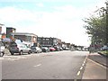

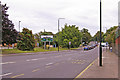
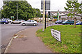
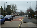
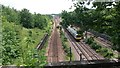
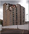
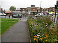
87 photos from this area
Area Information
Key information about the N11 2TE including its size, population, and administrative classification.
- Area Type
- Postcode
- Area Size
- 4163 m²
- Population
- 1817
- Population Density
- 11829 people/km²
House Prices in N11 2TE
25
Properties
£383,833
Average Sold Price
£97,000
Lowest Price
£751,000
Highest Price
Showing 25 properties
| Address | Type | Beds | Baths | Last Sale Price | Last Sale Date | |
|---|---|---|---|---|---|---|
| 14 York Road, Southgate, N11 2TE | Terraced | 3 | 2 | £751,000 | Dec 2023 | |
| 44 York Road, Southgate, N11 2TE | Terraced | 5 | 2 | £750,000 | Apr 2021 | |
| 24 York Road, Southgate, N11 2TE | Terraced | 3 | 1 | £462,000 | Jan 2012 | |
| 50 York Road, Southgate, N11 2TE | Flat | - | - | £470,000 | Aug 2007 | |
| 40 York Road, Southgate, N11 2TE | Terraced | - | - | £342,500 | Apr 2005 | |
| 30 York Road, Southgate, N11 2TE | Terraced | 4 | 2 | £205,000 | Jan 2002 | |
| 38 York Road, Southgate, N11 2TE | Terraced | - | - | £217,000 | May 2000 | |
| 26 York Road, Southgate, N11 2TE | house | - | - | £160,000 | Nov 1997 | |
| 42 York Road, Southgate, N11 2TE | house | - | - | £97,000 | Sep 1996 | |
| 28-28-A York Road, Southgate, N11 2TE | Flat | - | - | - | - |
Page 1 of 3
Energy Efficiency in N11 2TE
Amenities
Schools
| Rank | School | Type | Entry gender | Ages |
|---|
Explore more schools in this area
Go to Schools tabDemographics
Household Size
Family (3-5 people)
most common
Accommodation Type
Houses
most common
Tenure
60
majority
Ethnic Group
White
most common
Religion
N/A
most common
Household Composition
N/A
most common
Age
47
median
Adults (30-64 years)
most common
Household Deprivation
N/A
with no deprivation
NS-SEC
43
in Lower managerial occupations
Explore more demographic insights in this area
Go to Demographics tabPlanning
Planning Constraints
- Flood RiskPremium
- Ramsar Wetland SitesPremium
- Area of Outstanding Natural BeautyPremium
- Protected Nature ReservePremium
- Protected WoodlandPremium