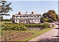
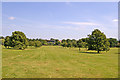
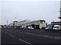
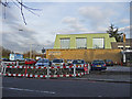
Area Overview for N11 2JF
Photos of N11 2JF


Area Information
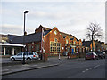
Living in N11 2JF means being part of a small, tightly knit residential cluster in north London. With a population of 1970, the area is compact yet well-served by transport and amenities. The community here skews towards adults aged 30–64, reflecting a mature demographic that values stability and proximity to services. Daily life is shaped by the area’s accessibility to nearby stations, retail hubs, and schools. While the postcode covers a limited geographical footprint, its strategic location near major transport routes ensures residents can reach central London or the surrounding suburbs within minutes. The low crime risk and absence of environmental constraints like protected woodlands or flood zones make it an appealing choice for those prioritising safety and practicality. Whether commuting, shopping, or accessing education, N11 2JF offers a balance of convenience and tranquillity, ideal for families and professionals seeking a manageable urban lifestyle.
- Area Type
- Postcode
- Area Size
- Not available
- Population
- 1970
- Population Density
- 10975 people/km²
The property market in N11 2JF is characterised by a 49% home ownership rate, meaning nearly half the population rents their homes. This suggests a rental market that may dominate over owner-occupation, particularly given the prevalence of flats as the primary accommodation type. Flats are likely to be the mainstay of the housing stock, which could appeal to younger professionals or families seeking lower-maintenance living. However, the small size of the area and its focus on flats may limit opportunities for buyers seeking larger properties or detached homes. For those considering purchasing, the market may be more competitive for flats, with limited scope for expansion. The area’s proximity to transport links and amenities could offset its smaller scale, making it attractive to buyers prioritising convenience over property size.
House Prices in N11 2JF
No properties found in this postcode.
Energy Efficiency in N11 2JF
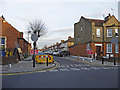
Residents of N11 2JF enjoy a range of amenities within practical reach. The area’s retail options include major chains like Tesco Bounds and Morrisons Palmers, ensuring access to groceries and daily essentials. Nearby ferry services, such as the London Zoo Waterbus Stop, offer unique transport links for leisure or commuting. The presence of multiple metro and rail stations, including Wood Green and Palmers Green, facilitates easy access to broader London. While the area lacks large parks or leisure facilities, the proximity to transport hubs and retail centres supports a convenient lifestyle. The mix of retail, transport, and ferry options suggests a community that prioritises accessibility over expansive recreational spaces. For those valuing ease of movement and proximity to services, N11 2JF provides a functional, if compact, environment.
Amenities
Schools
Residents of N11 2JF have access to two independent schools: Newriver Christian School and New Rainbow School. Both institutions fall under the independent sector, which typically offers smaller class sizes and specialised curricula compared to state schools. The presence of two independent options suggests a demand for alternative education pathways, possibly catering to families seeking non-traditional or faith-based schooling. While no Ofsted ratings are provided, the availability of independent schools may appeal to parents prioritising specific educational philosophies or resources. However, the absence of state school data means families relying on public education may need to look beyond the immediate area for options. The mix of school types reflects a community that values choice in education, though the exact quality of these institutions remains unspecified.
| Rank | School | Type | Entry gender | Ages |
|---|
Explore more schools in this area
Go to Schools tabDemographics
The population of N11 2JF is predominantly adults aged 30–64, with a median age of 47. This suggests a community of established professionals and families, rather than a younger or elderly demographic. Home ownership in the area stands at 49%, indicating a mix of owner-occupied and rental properties. The accommodation type is largely flats, reflecting a higher density of housing compared to detached homes. The predominant ethnic group is White, though no specific diversity statistics are provided. The low deprivation levels implied by these figures suggest residents have access to stable employment and services. However, the 49% home ownership rate also highlights that nearly half the population may be renting, which could influence the local property market dynamics. The absence of detailed diversity data means the community’s full demographic profile remains partially unexplored.
Household Size
Accommodation Type
Tenure
Ethnic Group
Religion
Household Composition
Age
Household Deprivation
NS-SEC
Explore more demographic insights in this area
Go to Demographics tabPlanning
Planning Constraints
- Flood RiskPremium
- Ramsar Wetland SitesPremium
- Area of Outstanding Natural BeautyPremium
- Protected Nature ReservePremium
- Protected WoodlandPremium