Area Overview for N11 1RL
Photos of N11 1RL

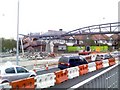


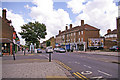

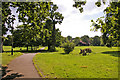


100 photos from this area
Area Information
Key information about the N11 1RL including its size, population, and administrative classification.
- Area Type
- Postcode
- Area Size
- 2.6 hectares
- Population
- 1791
- Population Density
- 10751 people/km²
House Prices in N11 1RL
47
Properties
£385,444
Average Sold Price
£108,000
Lowest Price
£940,000
Highest Price
Showing 47 properties
| Address | Type | Beds | Baths | Last Sale Price | Last Sale Date | |
|---|---|---|---|---|---|---|
| 71 Springfield Road, London, N11 1RL | Semi-detached | 6 | 3 | £940,000 | May 2024 | |
| 85 Springfield Road, London, N11 1RL | Flat | - | - | £190,000 | Jun 2023 | |
| 75 Springfield Road, London, N11 1RL | Terraced | 3 | 1 | £705,000 | Nov 2022 | |
| 59B Springfield Road, London, N11 1RL | Flat | 2 | 1 | £430,000 | Aug 2022 | |
| 49A Springfield Road, London, N11 1RL | Semi-detached | 5 | - | £445,000 | Jan 2022 | |
| 81 Springfield Road, London, N11 1RL | Flat | - | - | £325,000 | Sep 2019 | |
| 61 Springfield Road, London, N11 1RL | Flat | 3 | 2 | £430,000 | Jan 2019 | |
| 89 Springfield Road, London, N11 1RL | Semi-detached | 3 | 1 | £560,000 | Feb 2016 | |
| 57 Springfield Road, London, N11 1RL | Semi-detached | 5 | - | £580,000 | Apr 2014 | |
| 95 Springfield Road, London, N11 1RL | Semi-detached | 4 | - | £500,000 | Mar 2014 |
Page 1 of 5
Energy Efficiency in N11 1RL
Amenities
Schools
| Rank | School | Type | Entry gender | Ages |
|---|
Explore more schools in this area
Go to Schools tabDemographics
Household Size
Family (3-5 people)
most common
Accommodation Type
Flats
most common
Tenure
28
majority
Ethnic Group
White
most common
Religion
N/A
most common
Household Composition
N/A
most common
Age
47
median
Adults (30-64 years)
most common
Household Deprivation
N/A
with no deprivation
NS-SEC
25
in Lower managerial occupations
Explore more demographic insights in this area
Go to Demographics tabPlanning
Planning Constraints
- Flood RiskPremium
- Ramsar Wetland SitesPremium
- Area of Outstanding Natural BeautyPremium
- Protected Nature ReservePremium
- Protected WoodlandPremium