Area Overview for N11 1JH
Photos of N11 1JH
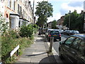

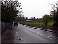
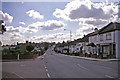
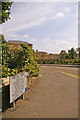
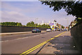
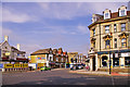
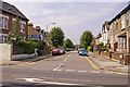


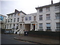

86 photos from this area
Area Information
Key information about the N11 1JH including its size, population, and administrative classification.
- Area Type
- Postcode
- Area Size
- 6830 m²
- Population
- 1867
- Population Density
- 7302 people/km²
House Prices in N11 1JH
35
Properties
£327,479
Average Sold Price
£65,000
Lowest Price
£595,000
Highest Price
Showing 35 properties
| Address | Type | Beds | Baths | Last Sale Price | Last Sale Date | |
|---|---|---|---|---|---|---|
| 49 Brunswick Park Road, New Southgate, London, N11 1JH | Terraced | 3 | 2 | £595,000 | Oct 2024 | |
| 93 Brunswick Park Road, New Southgate, London, N11 1JH | Terraced | 3 | 1 | £520,000 | Apr 2024 | |
| 91 Brunswick Park Road, New Southgate, London, N11 1JH | house | - | - | £577,000 | Feb 2024 | |
| 83 Brunswick Park Road, New Southgate, London, N11 1JH | Terraced | 4 | 1 | £516,000 | Feb 2024 | |
| 53 Brunswick Park Road, New Southgate, London, N11 1JH | Terraced | 3 | 1 | £572,000 | Oct 2023 | |
| 69 Brunswick Park Road, New Southgate, London, N11 1JH | house | - | - | £525,000 | Apr 2021 | |
| 33 Brunswick Park Road, New Southgate, London, N11 1JH | Terraced | 3 | - | £440,000 | Apr 2019 | |
| 27 Brunswick Park Road, New Southgate, London, N11 1JH | Terraced | 3 | - | £479,950 | Oct 2015 | |
| 51 Brunswick Park Road, New Southgate, London, N11 1JH | house | - | - | £280,000 | Dec 2011 | |
| 77 Brunswick Park Road, New Southgate, London, N11 1JH | house | 1 | 1 | £250,000 | Jul 2011 |
Page 1 of 4
Energy Efficiency in N11 1JH
Amenities
Schools
| Rank | School | Type | Entry gender | Ages |
|---|
Explore more schools in this area
Go to Schools tabDemographics
Household Size
One person
most common
Accommodation Type
Flats
most common
Tenure
47
majority
Ethnic Group
White
most common
Religion
N/A
most common
Household Composition
N/A
most common
Age
47
median
Adults (30-64 years)
most common
Household Deprivation
N/A
with no deprivation
NS-SEC
32
in Lower managerial occupations
Explore more demographic insights in this area
Go to Demographics tabPlanning
Planning Constraints
- Flood RiskPremium
- Ramsar Wetland SitesPremium
- Area of Outstanding Natural BeautyPremium
- Protected Nature ReservePremium
- Protected WoodlandPremium