Area Overview for N10 3TJ
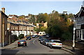
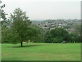
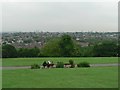
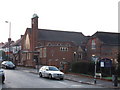
Photos of N10 3TJ


Area Information
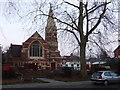
Living in N10 3TJ means inhabiting a compact, densely populated residential cluster in north London. The area covers just 805 square metres, yet it is home to 1,546 people, translating to a population density of nearly 1.9 million per square kilometre. This tight-knit postcode is characterised by its mix of flats, which dominate the housing stock, and its proximity to major transport hubs. Daily life here is shaped by the surrounding infrastructure, with easy access to metro, rail, and ferry services. The area’s small size means it is both a practical and strategic choice for those prioritising connectivity over space. While the density may feel intense, the presence of amenities like Co-op Muswell and nearby schools suggests a well-served community. N10 3TJ is not for those seeking sprawling gardens, but it offers a convenient, urban lifestyle with minimal commute times to central London. Its appeal lies in its balance of accessibility and the compactness of its footprint.
- Area Type
- Postcode
- Area Size
- 805 m²
- Population
- 1546
- Population Density
- 5280 people/km²
The property market in N10 3TJ is defined by its high density and reliance on flats. With 50% of homes owner-occupied, the area is neither purely a rental market nor a stronghold of long-term residents. The dominance of flats suggests limited scope for larger family homes or detached properties, which may deter buyers seeking more space. The small postcode size means the housing stock is finite, potentially leading to competition for available units. For buyers, this compactness can be both a challenge and an advantage: properties are likely to be well-maintained, with proximity to transport and amenities. However, the lack of varied housing types may restrict options for those needing specific layouts. The area’s appeal lies in its practicality, offering flats that are easy to access and close to key services, though it is not ideal for those prioritising expansive living spaces.
House Prices in N10 3TJ
Showing 1 properties
| Address | Type | Beds | Baths | Last Sale Price | Last Sale Date | |
|---|---|---|---|---|---|---|
| 5 Muswell Hill, Hornsey, London, N10 3TJ | Semi-detached | - | - | - | - |
Energy Efficiency in N10 3TJ
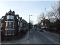
The lifestyle in N10 3TJ is defined by its proximity to a variety of amenities. Retail options include Co-op Muswell, M&S Muswell Hill, and Waitrose Little, offering everyday shopping needs. Transport links are extensive, with metro, rail, and ferry services providing multiple routes to and from central London. The area’s unique access to waterbus stops near London Zoo and Little Venice adds a touch of scenic commuting. Parks and green spaces are not explicitly mentioned, but the absence of protected natural areas suggests urban environments dominate. The compact nature of the postcode means residents can access shops, transport, and leisure in short distances. The mix of retail, transport, and waterfront access creates a dynamic daily life, though the lack of detailed information on parks or recreational facilities leaves some aspects of lifestyle undefined.
Amenities
Schools
N10 3TJ is served by three primary schools: Muswell Hill Junior School, Muswell Hill Infant School, and Muswell Hill Primary School, which holds a ‘good’ Ofsted rating. These institutions cater to younger children, providing a range of educational options for families. The presence of three primary schools in close proximity suggests a focus on early education, though no secondary schools are listed in the data. For parents, this means a reliable network of primary education, with one school specifically noted for its quality. The cluster of schools may indicate a strong local focus on family-oriented infrastructure, though secondary schooling would require commuting to nearby areas. The ‘good’ rating at Muswell Hill Primary School adds a layer of reassurance for families prioritising educational standards.
| Rank | School | Type | Entry gender | Ages |
|---|
Explore more schools in this area
Go to Schools tabDemographics
The community in N10 3TJ is predominantly composed of adults aged 30–64, with a median age of 47. This suggests a mature population, likely with established careers and families. Home ownership rates stand at 50%, meaning the area is split evenly between owner-occupied and rental properties. The accommodation type is almost exclusively flats, reflecting the constraints of the small postcode area. The predominant ethnic group is White, though specific data on diversity beyond this is not provided. The high population density—nearly 1.9 million people per square kilometre—implies a tightly packed living environment. While this density can foster a sense of community, it also means limited private outdoor space. The age profile indicates a stable demographic, with fewer young children or elderly residents compared to other areas. This balance may appeal to professionals or couples seeking a manageable, urban lifestyle without the complexities of larger families.
Household Size
Accommodation Type
Tenure
Ethnic Group
Religion
Household Composition
Age
Household Deprivation
NS-SEC
Explore more demographic insights in this area
Go to Demographics tabPlanning
Planning Constraints
- Flood RiskPremium
- Ramsar Wetland SitesPremium
- Area of Outstanding Natural BeautyPremium
- Protected Nature ReservePremium
- Protected WoodlandPremium