Area Overview for N10 3LD
Photos of N10 3LD

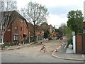
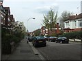


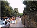

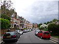


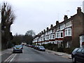
100 photos from this area
Area Information
Key information about the N10 3LD including its size, population, and administrative classification.
- Area Type
- Postcode
- Area Size
- 4.1 hectares
- Population
- 1476
- Population Density
- 3696 people/km²
House Prices in N10 3LD
20
Properties
£1,373,161
Average Sold Price
£185,000
Lowest Price
£2,893,000
Highest Price
Showing 20 properties
| Address | Type | Beds | Baths | Last Sale Price | Last Sale Date | |
|---|---|---|---|---|---|---|
| 19 Connaught Gardens, Hornsey, London, N10 3LD | Semi-detached | 4 | 2 | £1,540,000 | Jun 2025 | |
| 33 Connaught Gardens, Hornsey, London, N10 3LD | Semi-detached | 5 | 3 | £2,893,000 | Mar 2025 | |
| 35 Connaught Gardens, Hornsey, London, N10 3LD | Semi-detached | 5 | 2 | £1,675,000 | Jul 2023 | |
| 21 Connaught Gardens, Hornsey, London, N10 3LD | house | - | - | £1,225,000 | Aug 2022 | |
| 37 Connaught Gardens, Hornsey, London, N10 3LD | Semi-detached | 5 | 2 | £1,535,000 | Aug 2021 | |
| 23 Connaught Gardens, Hornsey, London, N10 3LD | Semi-detached | 4 | 2 | £1,425,000 | Jan 2021 | |
| 1 Connaught Gardens, Hornsey, London, N10 3LD | Semi-detached | 4 | 2 | £1,090,452 | Dec 2007 | |
| 27 Connaught Gardens, Hornsey, London, N10 3LD | Semi-detached | - | - | £790,000 | Apr 2006 | |
| 3 Connaught Gardens, Hornsey, London, N10 3LD | Semi-detached | 4 | 2 | £185,000 | Mar 1995 | |
| 29 Connaught Gardens, Hornsey, London, N10 3LD | house | 4 | - | - | - |
Page 1 of 2
Energy Efficiency in N10 3LD
Amenities
Schools
| Rank | School | Type | Entry gender | Ages |
|---|
Explore more schools in this area
Go to Schools tabDemographics
Household Size
Family (3-5 people)
most common
Accommodation Type
Houses
most common
Tenure
75
majority
Ethnic Group
White
most common
Religion
N/A
most common
Household Composition
N/A
most common
Age
47
median
Adults (30-64 years)
most common
Household Deprivation
N/A
with no deprivation
NS-SEC
63
in Lower managerial occupations
Explore more demographic insights in this area
Go to Demographics tabPlanning
Planning Constraints
- Flood RiskPremium
- Ramsar Wetland SitesPremium
- Area of Outstanding Natural BeautyPremium
- Protected Nature ReservePremium
- Protected WoodlandPremium