Area Overview for N10 3DL
Photos of N10 3DL
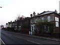
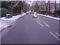
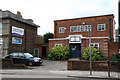
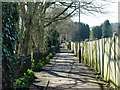
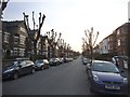
100 photos from this area
Area Information
Key information about the N10 3DL including its size, population, and administrative classification.
- Area Type
- Postcode
- Area Size
- 7.3 hectares
- Population
- 1476
- Population Density
- 3696 people/km²
House Prices in N10 3DL
27
Properties
£1,836,263
Average Sold Price
£490,000
Lowest Price
£4,390,000
Highest Price
Showing 27 properties
| Address | Type | Beds | Baths | Last Sale Price | Last Sale Date | |
|---|---|---|---|---|---|---|
| 89 Wood Vale, Hornsey, London, N10 3DL | house | - | - | £4,390,000 | Nov 2023 | |
| 95 Wood Vale, Hornsey, London, N10 3DL | house | 6 | 3 | £2,350,000 | Jun 2023 | |
| 53 Wood Vale, Hornsey, London, N10 3DL | Semi-detached | 7 | 2 | £2,100,000 | Feb 2023 | |
| 91 Wood Vale, Hornsey, London, N10 3DL | house | - | - | £2,780,000 | Aug 2021 | |
| 93 Wood Vale, Hornsey, London, N10 3DL | house | - | - | £2,400,000 | Jun 2021 | |
| 71 Wood Vale, Hornsey, London, N10 3DL | house | 6 | 1 | £2,000,000 | Jun 2016 | |
| 75 Wood Vale, Hornsey, London, N10 3DL | Semi-detached | 5 | - | £1,990,000 | Jul 2013 | |
| 57 Wood Vale, Hornsey, London, N10 3DL | Semi-detached | 7 | 2 | £1,699,950 | Apr 2012 | |
| 65 Wood Vale, Hornsey, London, N10 3DL | house | 5 | - | £1,194,000 | Apr 2011 | |
| 85 Wood Vale, Hornsey, London, N10 3DL | house | - | - | £1,750,000 | Oct 2009 |
Page 1 of 3
Energy Efficiency in N10 3DL
Amenities
Schools
| Rank | School | Type | Entry gender | Ages |
|---|
Explore more schools in this area
Go to Schools tabDemographics
Household Size
Family (3-5 people)
most common
Accommodation Type
Houses
most common
Tenure
75
majority
Ethnic Group
White
most common
Religion
N/A
most common
Household Composition
N/A
most common
Age
47
median
Adults (30-64 years)
most common
Household Deprivation
N/A
with no deprivation
NS-SEC
63
in Lower managerial occupations
Explore more demographic insights in this area
Go to Demographics tabPlanning
Planning Constraints
- Flood RiskPremium
- Ramsar Wetland SitesPremium
- Area of Outstanding Natural BeautyPremium
- Protected Nature ReservePremium
- Protected WoodlandPremium