Area Overview for N10 3AW
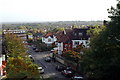
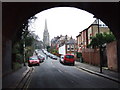
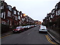
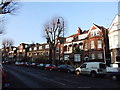
Photos of N10 3AW


Area Information
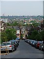
Living in N10 3AW offers a compact, residential experience shaped by its small cluster of homes and proximity to key amenities. With a population of 1,369, the area feels tightly knit, though its size means it’s more of a local hub than a sprawling suburb. The community is predominantly composed of adults aged 30–64, reflecting a mature demographic with strong ties to home ownership. Over 70% of residents own their properties, many of which are houses rather than flats, suggesting a focus on family-friendly living. The area’s low crime risk score of 79 and absence of environmental constraints like flood zones or protected natural sites make it appealing for those prioritising safety and stability. Nearby, Whittingham School provides independent education options, while transport links to Highgate, East Finchley, and Alexandra Palace Station ensure easy access to London’s broader networks. For buyers, N10 3AW represents a quiet, well-connected slice of north London, where daily life balances convenience with a sense of community.
- Area Type
- Postcode
- Area Size
- Not available
- Population
- 1369
- Population Density
- 8389 people/km²
The property market in N10 3AW is dominated by owner-occupied homes, with 70% of residents owning their properties. This high rate of home ownership indicates a stable, long-term community with limited turnover, which can be attractive to buyers seeking security. The accommodation type is primarily houses, reflecting a preference for family-sized homes over flats. Given the area’s small size, the housing stock is likely limited, making it a niche market for those prioritising proximity to specific amenities. The absence of rental-focused developments suggests that properties here are often held by residents with long-term ties to the area. For buyers, this means competition may be lower, but the pool of available homes could be constrained. The mix of houses also implies that properties are likely to be larger, which could be a consideration for those seeking specific space requirements.
House Prices in N10 3AW
No properties found in this postcode.
Energy Efficiency in N10 3AW
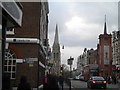
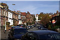
Daily life in N10 3AW is enriched by nearby amenities, including five retail outlets such as Planet Organic Muswell and Sainsburys Muswell, offering a mix of organic and mainstream shopping. The area’s transport links to Highgate, East Finchley, and Bounds Green provide access to larger retail and leisure hubs. For dining, the proximity to these stations suggests a range of options, though specific venues are not listed. Parks and green spaces are not explicitly mentioned, but the absence of environmental constraints like AONB or protected woodlands implies room for local recreational areas. The ferry services to London Zoo and Little Venice add cultural and leisure opportunities. Overall, the area’s amenities support a convenient, active lifestyle with easy access to both urban and natural environments.
Amenities
Schools
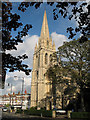
The nearest school to N10 3AW is Whittingham School, an independent institution. While no Ofsted rating is provided, the fact that it is independent suggests it may cater to families seeking private education options. The absence of other schools in the data means the area’s educational offerings are limited to this single institution, which could be a factor for families with children. Independent schools often come with higher fees, so this may influence decisions about schooling for residents. For those prioritising state education, the lack of nearby state schools might require commuting to nearby areas. However, the presence of a single independent school could be a draw for those seeking specific educational environments.
| Rank | School | Type | Entry gender | Ages |
|---|
Explore more schools in this area
Go to Schools tabDemographics
The residents of N10 3AW are largely adults aged 30–64, with a median age of 47. This suggests a population that is settled, with fewer young families or retirees compared to other areas. Home ownership is high at 70%, indicating a strong presence of long-term residents and a stable housing market. The accommodation type is primarily houses, which aligns with the area’s character as a residential cluster rather than a high-density development. The predominant ethnic group is White, though no specific data on diversity or deprivation is provided. The age profile and ownership rates imply a community focused on established living, with fewer transient populations. For buyers, this demographic suggests a market where properties are likely to remain in private hands rather than being rental-focused, potentially offering long-term value.
Household Size
Accommodation Type
Tenure
Ethnic Group
Religion
Household Composition
Age
Household Deprivation
NS-SEC
Explore more demographic insights in this area
Go to Demographics tabPlanning
Planning Constraints
- Flood RiskPremium
- Ramsar Wetland SitesPremium
- Area of Outstanding Natural BeautyPremium
- Protected Nature ReservePremium
- Protected WoodlandPremium