Area Overview for N10 2LD
Photos of N10 2LD


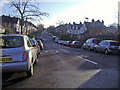
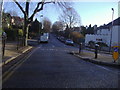

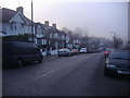


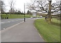

100 photos from this area
Area Information
Key information about the N10 2LD including its size, population, and administrative classification.
- Area Type
- Postcode
- Area Size
- 1.2 hectares
- Population
- 1495
- Population Density
- 8509 people/km²
House Prices in N10 2LD
50
Properties
£1,558,028
Average Sold Price
£237,500
Lowest Price
£2,745,000
Highest Price
Showing 50 properties
| Address | Type | Beds | Baths | Last Sale Price | Last Sale Date | |
|---|---|---|---|---|---|---|
| 109 Rosebery Road, Hornsey, London, N10 2LD | Terraced | 5 | 3 | £2,600,000 | Feb 2025 | |
| 113 Rosebery Road, Hornsey, London, N10 2LD | Terraced | 6 | 3 | £2,745,000 | Jan 2024 | |
| 125 Rosebery Road, Hornsey, London, N10 2LD | Detached | 5 | 3 | £2,700,000 | Nov 2022 | |
| 105 Rosebery Road, Hornsey, London, N10 2LD | Semi-detached | 5 | 3 | £2,600,000 | May 2019 | |
| 107 Rosebery Road, Hornsey, London, N10 2LD | Terraced | 5 | 4 | £2,025,000 | Dec 2018 | |
| 81 Rosebery Road, Hornsey, London, N10 2LD | Terraced | 4 | 3 | £1,800,000 | Jul 2017 | |
| 129 Rosebery Road, Hornsey, London, N10 2LD | Terraced | 4 | 2 | £1,700,000 | Dec 2016 | |
| 101 Rosebery Road, Hornsey, London, N10 2LD | Terraced | 4 | - | £1,500,000 | Jan 2014 | |
| 117 Rosebery Road, Hornsey, London, N10 2LD | Terraced | 5 | 3 | £2,150,000 | Nov 2013 | |
| 115 Rosebery Road, Hornsey, London, N10 2LD | Flat | 2 | 1 | £789,950 | Sep 2013 |
Page 1 of 5
Energy Efficiency in N10 2LD
Amenities
Schools
| Rank | School | Type | Entry gender | Ages |
|---|
Explore more schools in this area
Go to Schools tabDemographics
Household Size
Family (3-5 people)
most common
Accommodation Type
Houses
most common
Tenure
75
majority
Ethnic Group
White
most common
Religion
N/A
most common
Household Composition
N/A
most common
Age
47
median
Adults (30-64 years)
most common
Household Deprivation
N/A
with no deprivation
NS-SEC
62
in Lower managerial occupations
Explore more demographic insights in this area
Go to Demographics tabPlanning
Planning Constraints
- Flood RiskPremium
- Ramsar Wetland SitesPremium
- Area of Outstanding Natural BeautyPremium
- Protected Nature ReservePremium
- Protected WoodlandPremium