Area Overview for N10 1PR
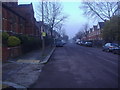
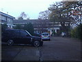
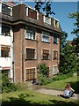
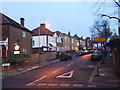
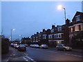
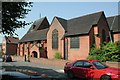
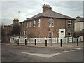
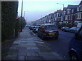
Photos of N10 1PR


Area Information
Living in N10 1PR means inhabiting a tightly packed residential cluster in north London, where 1,782 people reside across just 3,378 square metres. This high population density creates a compact, community-oriented environment, with homes clustered closely together. The area is defined by its proximity to transport hubs and amenities, making it practical for those reliant on public transport. Despite its small size, N10 1PR is well-connected to surrounding districts, with residents able to access major roads, rail lines, and waterways. The area’s character is shaped by its mature demographic, with a median age of 47 and a majority of residents aged 30–64. This suggests a stable, established community, likely with long-term residents who value convenience over space. Daily life here balances urban accessibility with the quiet of a residential postcode, though the density may mean limited green spaces or private outdoor areas. For buyers, the challenge lies in the small area size, which limits housing availability but ensures proximity to key services.
- Area Type
- Postcode
- Area Size
- 3378 m²
- Population
- 1782
- Population Density
- 9345 people/km²
The property market in N10 1PR is defined by its high density and reliance on flats. With 46% of residents owning their homes, the area is not dominated by owner-occupation, suggesting a significant rental market. The prevalence of flats indicates limited availability of larger homes, which may appeal to buyers seeking compact, manageable properties. Given the small area size, the housing stock is constrained, and buyers should consider the proximity to transport and amenities as key selling points. The compact nature of the area may also mean competition for properties, particularly for those prioritising location over space. For renters, the high density supports a steady supply of flats, but for buyers, the challenge lies in finding a property that balances affordability with the area’s advantages. The small postcode means the immediate surroundings are critical, with nearby districts offering more varied housing options.
House Prices in N10 1PR
Showing 7 properties
| Address | Type | Beds | Baths | Last Sale Price | Last Sale Date | |
|---|---|---|---|---|---|---|
| Bungalow 1, Chester House, 30 Pages Lane, Hornsey, London, N10 1PR | Detached | - | - | - | - | |
| 1, Chester House, 30 Pages Lane, Hornsey, London, N10 1PR | Flat | 2 | 1 | - | - | |
| Bungalow 2, Chester House, 30 Pages Lane, Hornsey, London, N10 1PR | office_workshop | - | - | - | - | |
| Lower Ground Floor Front Office, Chester House, 30 Pages Lane, Hornsey, London, N10 1PR | residential_space | - | - | - | - | |
| Lower Ground Floor Right West Office, Chester House, 30 Pages Lane, Hornsey, London, N10 1PR | office_workshop | - | - | - | - | |
| Ten Ten Theatre, Lower Ground Office, Chester House, 30 Pages Lane, Hornsey, London, N10 1PR | Office | - | - | - | - | |
| Lower Ground Floor Right East Office, Chester House, 30 Pages Lane, Hornsey, London, N10 1PR | Office | - | - | - | - |
Energy Efficiency in N10 1PR
Residents of N10 1PR have access to a range of amenities within practical reach. Retail options include Waitrose Little Waitrose, Aldi 412 Muswell Hill Broadway, and other local stores, ensuring everyday shopping needs are met. The area’s transport links also open doors to broader leisure opportunities, with nearby metro, rail, and ferry services connecting to parks, cultural sites, and commercial centres. The proximity to waterways, such as the Grand Union Canal, adds a unique dimension to the lifestyle, with ferry stops offering easy access to scenic routes. While the area’s compact size may limit large-scale recreational spaces, the density of services and transport options compensates with convenience. The mix of retail, transport, and water-based connectivity suggests a lifestyle focused on accessibility and efficiency, ideal for those who prioritise ease of movement over expansive private spaces.
Amenities
Schools
The schools near N10 1PR include Our Lady of Muswell Catholic Primary School, which is a state primary school with an outstanding Ofsted rating. This provides a high-quality education option for younger families. The area also hosts two independent schools: The Hornsey Centre for Children and Unique Children’s School, the latter of which holds a good Ofsted rating. The mix of state and independent schools offers flexibility for parents, though independent schools may come with higher fees. For families prioritising academic excellence, the outstanding-rated primary school is a strong draw, while the independent options cater to those seeking alternative educational approaches. The presence of multiple school types suggests the area is popular with families, though the limited number of schools may mean competition for places at top-rated institutions.
| Rank | School | Type | Entry gender | Ages |
|---|
Explore more schools in this area
Go to Schools tabDemographics
The community in N10 1PR is predominantly composed of adults aged 30–64, with a median age of 47. This suggests a mature, settled population, likely with established careers and families. Home ownership sits at 46%, meaning nearly half of residents rent, which may indicate a mix of long-term residents and those in transient housing. The accommodation type is overwhelmingly flats, reflecting the area’s compact nature and high density. The predominant ethnic group is White, though specific diversity data is not provided. The population density of 527,456 people per square kilometre is exceptionally high, which may influence the character of daily life—more likely to involve shared spaces, communal areas, and a strong sense of local interaction. This density also means limited private outdoor space, which could be a consideration for those prioritising garden access. The data does not indicate deprivation levels, but the high density and flat-dominated housing suggest a focus on affordability and proximity to services over expansive living areas.
Household Size
Accommodation Type
Tenure
Ethnic Group
Religion
Household Composition
Age
Household Deprivation
NS-SEC
Explore more demographic insights in this area
Go to Demographics tabPlanning
Planning Constraints
- Flood RiskPremium
- Ramsar Wetland SitesPremium
- Area of Outstanding Natural BeautyPremium
- Protected Nature ReservePremium
- Protected WoodlandPremium