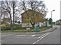
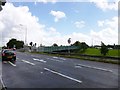
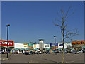
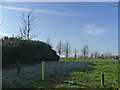
Area Overview for N10 1BE
Photos of N10 1BE


Area Information
Living in N10 1BE means being part of a compact, residential postcode area with a population of 1,712. This small cluster of homes is served by a range of transport links, including rail, metro, and waterbus routes, making it easy to connect to nearby hubs. The area’s character is shaped by its mature demographic, with a median age of 47 and a majority of residents aged between 30 and 64. Daily life here balances proximity to urban amenities with a quieter residential feel. The presence of a primary school, Coppetts Wood Primary, adds to the appeal for families, though secondary education options require a short commute. With 42% of homes owner-occupied and flats dominating the housing stock, the area suits those seeking rental properties or smaller living spaces. The broadband score of 69 and mobile coverage of 85 ensure most residents can work remotely, while the moderate crime risk means standard security measures are advisable. N10 1BE is a pragmatic choice for those prioritising convenience and connectivity over sprawling suburban landscapes.
- Area Type
- Postcode
- Area Size
- Not available
- Population
- 1712
- Population Density
- 3129 people/km²
The property market in N10 1BE is characterised by a 42% home ownership rate, meaning the majority of properties are rented. Flats dominate the housing stock, reflecting a focus on smaller, managed units rather than detached or semi-detached homes. This suggests the area is more aligned with rental markets than owner-occupation, possibly due to its compact size and proximity to transport links. For buyers, the limited number of properties available means competition may be higher, particularly for flats in well-maintained buildings. The small postcode area implies that the immediate surroundings offer few alternatives, so buyers must consider the broader local market. The dominance of flats also indicates that the area may cater to professionals or families seeking manageable, low-maintenance housing rather than larger properties.
House Prices in N10 1BE
No properties found in this postcode.
Energy Efficiency in N10 1BE
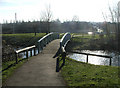
Residents of N10 1BE have access to a range of amenities within practical reach. Retail options include Tesco Colney, M&S Friern, and Waitrose Little Waitrose, offering everything from groceries to fashion. The area’s transport links connect to major hubs, while waterbus stops provide scenic routes along the Thames. Parks and open spaces are not explicitly listed, but the proximity to Alexandra Palace and nearby green spaces suggests recreational opportunities. The mix of retail, transport, and water-based connectivity creates a convenient lifestyle, blending urban accessibility with manageable living. For those who enjoy a balance of shopping, commuting, and leisure, N10 1BE provides a functional base with minimal need for car ownership.
Amenities
Schools
The nearest school to N10 1BE is Coppetts Wood Primary School, which serves the local community with a satisfactory Ofsted rating. As a primary school, it caters to younger children, but families requiring secondary education will need to look further afield. The presence of a primary school within the area is a key factor for parents seeking convenience, though the lack of secondary schools nearby means planning for future educational needs is essential. The school’s rating suggests it meets basic standards, but parents may wish to investigate additional options in surrounding areas. For those prioritising proximity to schools, N10 1BE offers a starting point, but long-term schooling arrangements should be considered.
| Rank | School | Type | Entry gender | Ages |
|---|
Explore more schools in this area
Go to Schools tabDemographics
The community in N10 1BE is predominantly composed of adults aged 30 to 64, reflecting a mature population with a median age of 47. Home ownership stands at 42%, indicating that over half of residents rent their homes. Flats are the most common accommodation type, suggesting a mix of purpose-built housing and conversions. The predominant ethnic group is White, though no specific data on diversity or deprivation is provided. The age profile implies a stable, established community, likely with a mix of long-term residents and professionals working in nearby sectors. With 42% of homes owned, the area leans towards rental markets, which may influence local dynamics and property values. The absence of detailed diversity statistics means the full cultural makeup remains unexplored, but the demographic stability suggests a low turnover of residents.
Household Size
Accommodation Type
Tenure
Ethnic Group
Religion
Household Composition
Age
Household Deprivation
NS-SEC
Explore more demographic insights in this area
Go to Demographics tabPlanning
Planning Constraints
- Flood RiskPremium
- Ramsar Wetland SitesPremium
- Area of Outstanding Natural BeautyPremium
- Protected Nature ReservePremium
- Protected WoodlandPremium