Area Overview for N1 9GU
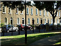
Photos of N1 9GU


Area Information
Living in N1 9GU means being part of a compact, residential postcode area in north London with a population of 2029. This small cluster is characterised by its proximity to major transport hubs and a mix of retail and leisure facilities. The area’s residents benefit from easy access to London’s transport network, including King’s Cross and St Pancras stations, which connect to national rail routes and the Underground. Daily life here is shaped by the surrounding infrastructure, with shops, cafes, and public services within walking distance. The median age of 47 suggests a mature community, and the prevalence of flats indicates a focus on urban living. While the area lacks natural landscapes, its strategic location near central London offers convenience for commuters and access to cultural amenities. However, the high crime risk score of 1/100 underscores the need for vigilance. For those prioritising connectivity and proximity to the city, N1 9GU provides a practical base, though buyers should weigh the trade-offs between accessibility and safety.
- Area Type
- Postcode
- Area Size
- Not available
- Population
- 2029
- Population Density
- 13402 people/km²
The property market in N1 9GU is defined by its low home ownership rate of 24%, which points to a rental-dominated landscape. The accommodation type is almost entirely flats, a common feature in urban areas with limited land availability. This suggests that the area is not ideal for buyers seeking larger homes or detached properties. The small population and compact nature of the postcode mean that the housing stock is concentrated, with limited scope for expansion. For those considering purchase, the market is likely to be competitive for flats, but opportunities for owner-occupation are scarce. The proximity to transport links may attract investors, but the high crime risk score could deter some buyers. Overall, the property market here is best suited for those prioritising rental affordability and urban convenience over long-term ownership.
House Prices in N1 9GU
No properties found in this postcode.
Energy Efficiency in N1 9GU
Life in N1 9GU is shaped by its proximity to a range of amenities. Retail options include Waitrose Kings, Tesco Kings, and other local shops, providing convenience for daily shopping. The area’s transport links are unparalleled, with major stations like London Kings Cross Railway Station and St Pancras International Station within reach. For leisure, ferry services such as the Camden Lock Waterbus offer access to riverside activities. The presence of multiple bus stops, including Green Line Coach Station, ensures flexibility for travel beyond the city. While the area lacks extensive parks or green spaces, its urban layout prioritises accessibility over natural landscapes. The mix of retail, transport, and leisure options creates a dynamic environment, though the small postcode size means amenities are concentrated rather than spread out.
Amenities
Schools
The nearest school to N1 9GU is Winton Primary School, a primary institution with an outstanding Ofsted rating. This rating indicates a high standard of education, with effective teaching and strong pupil outcomes. As the only school listed in the data, it serves as a key draw for families in the area. However, the absence of secondary schools or other educational institutions means parents may need to look beyond N1 9GU for comprehensive schooling. The outstanding rating at Winton Primary is a positive factor, but families should consider the broader educational landscape when evaluating the area. The school’s performance suggests that children here are likely to receive quality early education, though further research would be needed to assess long-term opportunities.
| Rank | School | Type | Entry gender | Ages |
|---|
Explore more schools in this area
Go to Schools tabDemographics
The community in N1 9GU is predominantly composed of adults aged 30–64, with a median age of 47. This suggests a population largely in their prime working years, which may influence local services and amenities. Home ownership is relatively low at 24%, indicating that most residents rent their properties. The area is dominated by flats, reflecting its urban character and limited space for larger housing types. The predominant ethnic group is White, though no specific data on diversity or deprivation is provided. The age profile implies a stable, established population, but the low home ownership rate may affect long-term community cohesion. For buyers, this demographic profile suggests a market skewed towards renters, with limited scope for owner-occupied properties. The absence of detailed diversity metrics means the full social fabric of the area remains partially unexplored.
Household Size
Accommodation Type
Tenure
Ethnic Group
Religion
Household Composition
Age
Household Deprivation
NS-SEC
Explore more demographic insights in this area
Go to Demographics tabPlanning
Planning Constraints
- Flood RiskPremium
- Ramsar Wetland SitesPremium
- Area of Outstanding Natural BeautyPremium
- Protected Nature ReservePremium
- Protected WoodlandPremium