Area Overview for N1 8SQ
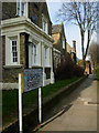
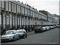
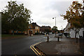
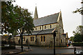
Photos of N1 8SQ


Area Information
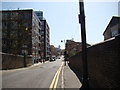
Living in N1 8SQ means inhabiting a compact residential cluster in north London, where the population of 1,824 reflects a tight-knit community. The area’s character is defined by its proximity to transport hubs and a mix of local amenities. Residents benefit from easy access to rail, metro, and bus services, with stations like Essex Road and Highbury & Islington within reach. Daily life here is shaped by a balance of practicality and connectivity, with shops, schools, and green spaces nearby. The area’s small size means it is not densely populated, offering a quieter alternative to larger urban centres. While it lacks major landmarks, its appeal lies in its accessibility to London’s broader networks. For those seeking a base with reliable transport and a manageable population, N1 8SQ provides a straightforward, functional living environment. The presence of primary schools and community-focused retail options adds to its appeal for families.
- Area Type
- Postcode
- Area Size
- Not available
- Population
- 1824
- Population Density
- 16780 people/km²
The property market in N1 8SQ is characterised by a high proportion of rental properties, with only 21% of homes owned by residents. This suggests a market skewed towards tenants rather than buyers, possibly due to the area’s compact size and limited housing stock. The accommodation type is predominantly flats, which are well-suited to urban living but may lack the space or flexibility of larger homes. For buyers, this means the area is unlikely to offer a wide range of properties, particularly for those seeking owner-occupied homes. The small population and limited land area mean that new developments are rare, and the existing stock is likely to be older or converted. Those considering the area should focus on rental opportunities or properties that meet specific needs, such as proximity to transport or schools. The market’s constraints make it a niche option for those prioritising location over property diversity.
House Prices in N1 8SQ
No properties found in this postcode.
Energy Efficiency in N1 8SQ
Residents of N1 8SQ enjoy a range of nearby amenities that support daily life. Retail options include Tesco New, Planet Organic Islington, and The Southern Co-operative Co, offering everything from groceries to organic products. Transport hubs like Essex Road Station and Angel Station provide easy access to London’s transport network, while ferry services such as Blackfriars Pier and Camden Lock Waterbus add alternative travel routes. The area’s proximity to multiple bus stops and coach stations enhances mobility, particularly for commuters. The presence of these amenities suggests a practical, convenience-focused lifestyle, with minimal need to travel far for essentials. While the area lacks large-scale leisure facilities, its connectivity to London’s broader networks means residents can access cultural or recreational opportunities elsewhere with ease.
Amenities
Schools
Residents of N1 8SQ have access to several primary schools, including Charles Lamb Primary School, Rotherfield Junior School, Rotherfield Infant School, and Rotherfield Primary School, which holds an Ofsted rating of ‘good’. New North Community School is also within reach. The concentration of primary schools indicates that the area is well-served for families with young children, though no secondary schools are listed. The presence of multiple schools may allow parents to choose between different educational environments, though the absence of secondary options could require commuting. The ‘good’ rating at Rotherfield Primary suggests a reliable standard of education, which is a key consideration for prospective buyers. However, the lack of data on school performance beyond Ofsted ratings means that further research into teaching quality or facilities would be necessary for a full assessment.
| Rank | School | Type | Entry gender | Ages |
|---|
Explore more schools in this area
Go to Schools tabDemographics
The community in N1 8SQ is predominantly composed of adults aged 30–64, with a median age of 47. This suggests a mature, stable population, likely with established careers and families. Home ownership is low, at just 21%, indicating that most residents rent their homes. The accommodation type is primarily flats, reflecting a housing stock suited to urban living rather than detached properties. The predominant ethnic group is White, though no specific data on diversity or deprivation is provided. The small population of 1,824 implies a close-knit environment where social ties may be strong. The age profile suggests a mix of professionals and older residents, with fewer young families or retirees represented. This demographic structure may influence local services and amenities, with a focus on adult-oriented needs rather than childcare or retirement facilities.
Household Size
Accommodation Type
Tenure
Ethnic Group
Religion
Household Composition
Age
Household Deprivation
NS-SEC
Explore more demographic insights in this area
Go to Demographics tabPlanning
Planning Constraints
- Flood RiskPremium
- Ramsar Wetland SitesPremium
- Area of Outstanding Natural BeautyPremium
- Protected Nature ReservePremium
- Protected WoodlandPremium