Area Overview for N1 8PB
Photos of N1 8PB
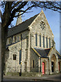
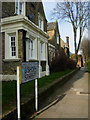
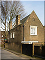
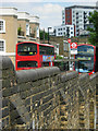
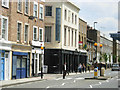
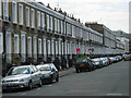
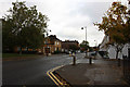
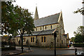
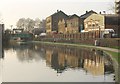

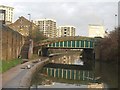
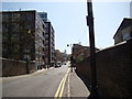
100 photos from this area
Area Information
Key information about the N1 8PB including its size, population, and administrative classification.
- Area Type
- Postcode
- Area Size
- 2717 m²
- Population
- 1852
- Population Density
- 17076 people/km²
House Prices in N1 8PB
21
Properties
£989,213
Average Sold Price
£184,625
Lowest Price
£1,600,000
Highest Price
Showing 21 properties
| Address | Type | Beds | Baths | Last Sale Price | Last Sale Date | |
|---|---|---|---|---|---|---|
| 1 Frome Street, London, N1 8PB | Terraced | 1 | 1 | £650,000 | May 2022 | |
| 5 Frome Street, London, N1 8PB | house | 2 | 2 | £1,100,000 | Apr 2022 | |
| 23 Frome Street, London, N1 8PB | Terraced | 3 | 2 | £1,600,000 | Nov 2021 | |
| 11 Frome Street, London, N1 8PB | house | 3 | 1 | £1,230,000 | Jun 2021 | |
| 33 Frome Street, London, N1 8PB | house | - | - | £1,600,000 | Apr 2021 | |
| 31 Frome Street, London, N1 8PB | house | 3 | 1 | £1,560,000 | Oct 2017 | |
| 37 Frome Street, London, N1 8PB | Flat | - | - | £184,625 | Jan 2017 | |
| 17 Frome Street, London, N1 8PB | house | 3 | - | £870,000 | Jun 2013 | |
| 29 Frome Street, London, N1 8PB | house | - | - | £672,500 | May 2006 | |
| 19 Frome Street, London, N1 8PB | Detached | 1 | 1 | £425,000 | Jan 2002 |
Page 1 of 3
Energy Efficiency in N1 8PB
Amenities
Schools
| Rank | School | Type | Entry gender | Ages |
|---|
Explore more schools in this area
Go to Schools tabDemographics
Household Size
Two person
most common
Accommodation Type
Flats
most common
Tenure
36
majority
Ethnic Group
White
most common
Religion
N/A
most common
Household Composition
N/A
most common
Age
47
median
Adults (30-64 years)
most common
Household Deprivation
N/A
with no deprivation
NS-SEC
54
in Lower managerial occupations
Explore more demographic insights in this area
Go to Demographics tabPlanning
Planning Constraints
- Flood RiskPremium
- Ramsar Wetland SitesPremium
- Area of Outstanding Natural BeautyPremium
- Protected Nature ReservePremium
- Protected WoodlandPremium