Area Overview for N1 6XF
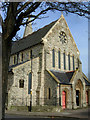
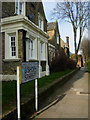
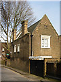
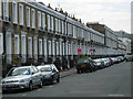
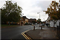
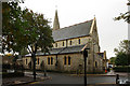
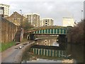
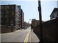
Photos of N1 6XF


Area Information
Living in N1 6XF offers a compact, residential experience shaped by its small cluster of homes and proximity to central London’s transport networks. With a population of 1,539, the area is a tight-knit community where daily life is influenced by its location near key infrastructure. Residents benefit from excellent digital connectivity, with broadband scoring 99 out of 100, ensuring seamless online access for work or leisure. The area is served by multiple rail, metro, and ferry routes, including Essex Road Station and Blackfriars Pier, making commuting straightforward. While the postcode lacks natural features like protected woodlands or AONB designations, it is free from flood risk, offering peace of mind. The presence of Thomas Fairchild Community School, rated good by Ofsted, adds to its appeal for families. N1 6XF is ideal for those prioritising convenience, connectivity, and proximity to London’s core, though its small size means housing options are limited to flats, reflecting a rental-dominated market.
- Area Type
- Postcode
- Area Size
- Not available
- Population
- 1539
- Population Density
- 15593 people/km²
The property market in N1 6XF is characterised by a low home ownership rate of 25%, suggesting that the area is largely a rental market rather than one dominated by owner-occupiers. The accommodation type is predominantly flats, which aligns with the small, residential nature of the postcode. This configuration limits the availability of larger homes or detached properties, making the area more suited to individuals or smaller households. Buyers considering N1 6XF should note that the limited housing stock means competition for available properties is likely to be high, particularly for flats. The small size of the area also means that the immediate surroundings may offer more options, but proximity to central London’s transport hubs could make the area attractive to investors seeking rental yields. However, the lack of data on property prices or recent sales trends means potential buyers must conduct further local research.
House Prices in N1 6XF
No properties found in this postcode.
Energy Efficiency in N1 6XF
Life in N1 6XF is defined by its proximity to a range of amenities, from retail to transport hubs. The area’s retail options include Co-op Gainsborough, Tesco Southgate, and The Southern Co-operative, providing everyday shopping convenience. Residents have access to multiple rail and metro stations, including Hoxton and Chancery Lane, which link to central London’s business and cultural districts. Ferry services at Tower Pier and Blackfriars Pier offer scenic travel options, while bus routes from Victoria Coach Station connect to wider regional networks. The area’s compact size means amenities are within walking distance, though the absence of parks or leisure facilities in the data suggests that outdoor recreation may require travel to nearby green spaces. The combination of retail, transport, and connectivity fosters a dynamic lifestyle, ideal for those who value accessibility and urban convenience.
Amenities
Schools
The nearest school to N1 6XF is Thomas Fairchild Community School, a primary school with a good Ofsted rating. This provides a reliable educational option for families with young children, though the data does not include secondary schools in the area. The presence of a primary school with a positive rating is a significant advantage, as it ensures access to quality early education. However, residents seeking secondary schooling may need to look beyond the immediate vicinity. The absence of additional schools in the data highlights the importance of verifying further options, such as nearby state or private institutions. For families prioritising a strong local education system, Thomas Fairchild Community School offers a solid foundation, but the overall school landscape in N1 6XF remains limited to primary-level provision.
| Rank | School | Type | Entry gender | Ages |
|---|
Explore more schools in this area
Go to Schools tabDemographics
The community in N1 6XF is predominantly composed of adults aged 30–64, with a median age of 47. This suggests a mature population, likely with established careers and families. Home ownership is low at 25%, indicating that most residents are renters, which is typical of urban areas with limited housing stock. The accommodation type is primarily flats, a common feature in densely populated zones. The predominant ethnic group is White, though the data does not provide further breakdowns of diversity. The absence of specific deprivation data means quality of life factors like access to services and employment opportunities are not quantified here. However, the area’s proximity to transport and amenities implies a level of convenience that supports daily living. The demographic profile reflects a stable, middle-aged population, which may influence local services and community dynamics.
Household Size
Accommodation Type
Tenure
Ethnic Group
Religion
Household Composition
Age
Household Deprivation
NS-SEC
Explore more demographic insights in this area
Go to Demographics tabPlanning
Planning Constraints
- Flood RiskPremium
- Ramsar Wetland SitesPremium
- Area of Outstanding Natural BeautyPremium
- Protected Nature ReservePremium
- Protected WoodlandPremium