Area Overview for N1 6UT
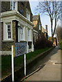
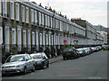
Photos of N1 6UT


Area Information
Living in N1 6UT means being part of a small, tightly knit residential cluster in England, home to 1,539 people. The area’s compact size fosters a quiet, community-focused environment, with a population skewed toward adults aged 30–64, reflecting a mature demographic. This postcode is not defined by sprawling developments but by its proximity to key transport hubs and amenities. Residents benefit from excellent broadband connectivity, rated 99 out of 100, ensuring seamless online access for work or leisure. While the area lacks natural beauty designations like AONB or Ramsar sites, its practicality is evident in the ease of reaching London’s transport network. The mix of retail, rail, and ferry options within walking distance means daily life here is efficient, with minimal need to travel far. For those seeking a balance between urban convenience and residential calm, N1 6UT offers a straightforward, no-frills lifestyle. Its modest population and low flood risk further underline its reliability as a place to live.
- Area Type
- Postcode
- Area Size
- Not available
- Population
- 1539
- Population Density
- 15593 people/km²
The property market in N1 6UT is characterised by a low home ownership rate of 25%, suggesting that the majority of housing stock is rented rather than owned. The accommodation type is overwhelmingly flats, which aligns with the area’s small, urban footprint and limited space for larger properties. This configuration implies a rental-focused market, where landlords may dominate the landscape. For buyers, this means limited opportunities for purchasing property, as the area is not a traditional owner-occupied community. The scarcity of homes for sale could make it challenging for those seeking to buy, though the proximity to transport links and amenities might offset this. The small size of N1 6UT also means that the immediate surroundings are critical for property seekers, as the local market is unlikely to expand beyond its boundaries. Those considering homes here should factor in the likelihood of competing with renters and the potential for limited long-term equity growth.
House Prices in N1 6UT
No properties found in this postcode.
Energy Efficiency in N1 6UT
Life in N1 6UT is shaped by its proximity to a range of retail, transport, and leisure facilities. The area’s retail scene includes notable stores like Co-op Gainsborough, Tesco Southgate, and The Southern Co-operative, providing everyday shopping convenience. For transport, residents can access rail services at Essex Road Station and Hoxton Station, as well as metro stops at Angel and St. Paul’s, ensuring easy movement across London. Ferry options at Blackfriars Pier and Tower Pier add another layer of mobility, particularly for those working or socialising near the Thames. The presence of bus stations like Victoria Coach Station further enhances connectivity. While the data does not specify parks or dining venues, the density of transport and retail options suggests a lifestyle focused on efficiency and urban convenience. The area’s practicality makes it ideal for those who prioritise accessibility over sprawling green spaces.
Amenities
Schools
The nearest school to N1 6UT is Thomas Fairchild Community School, a primary school with a good Ofsted rating. This institution serves the local community, providing education for younger children in the area. While no secondary schools are listed in the data, the presence of a well-rated primary school suggests that families with young children may find the area suitable for their needs. The school’s good rating indicates a standard of education that meets or exceeds average benchmarks, though it does not provide information on specialist facilities or extracurricular offerings. For parents prioritising primary education, Thomas Fairchild Community School offers a reliable option. However, those requiring secondary schooling may need to look further afield, as the data does not include details about higher-level educational institutions in the immediate vicinity.
| Rank | School | Type | Entry gender | Ages |
|---|
Explore more schools in this area
Go to Schools tabDemographics
The community in N1 6UT is predominantly composed of adults aged 30–64, with a median age of 47. This suggests a stable, middle-aged population, likely with established careers and families. Home ownership here is relatively low, at 25%, indicating that a significant portion of residents rent their homes. The accommodation type is almost exclusively flats, reflecting a compact housing stock suited to urban living. The predominant ethnic group is White, though no specific data on diversity or deprivation is provided. The age profile and home ownership rate suggest a community that may be more transient than owner-occupied areas, with a focus on practicality over long-term investment. The absence of detailed diversity metrics means the area’s cultural composition remains less defined in the data. However, the presence of a primary school with a good Ofsted rating indicates a family-oriented environment, even if the broader demographic picture is limited.
Household Size
Accommodation Type
Tenure
Ethnic Group
Religion
Household Composition
Age
Household Deprivation
NS-SEC
Explore more demographic insights in this area
Go to Demographics tabPlanning
Planning Constraints
- Flood RiskPremium
- Ramsar Wetland SitesPremium
- Area of Outstanding Natural BeautyPremium
- Protected Nature ReservePremium
- Protected WoodlandPremium