Area Overview for N1 6RG
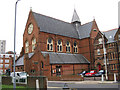
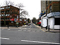
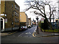
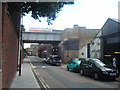
Photos of N1 6RG


Area Information
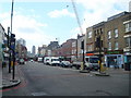
Living in N1 6RG means residing in a small residential cluster within London defined by the postcode N1 6RG. This specific area covers just 5,924 square metres, creating a compact community of 2,633 residents. You are looking at a population density of 444,435 people per square kilometre, which places this cluster inside a significantly larger council ward. The median age for those living in N1 6RG is 47 years old, suggesting a mature resident base. Daily life here is characterised by close proximity to major infrastructure and employment hubs. You are surrounded by the energy of the wider neighbourhood while maintaining a distinct local identity. The area serves as one small part of a much larger urban landscape. Prospective buyers should view this postcode not as an isolated pocket but as an integrated slice of a dense London district. The small footprint means distance to amenities is negligible, but the high density means you are part of a very built-up environment.
- Area Type
- Postcode
- Area Size
- 5924 m²
- Population
- 2633
- Population Density
- 17086 people/km²
The property market in N1 6RG is overwhelmingly defined by rental ownership rather than ownership outright. Exactly 16 per cent of homes are owner-occupied, which means the standard arrangement for living in this postcode is renting. The available accommodation data identifies flats as the primary type of dwelling in this cluster. With only 5,924 square metres forming the entire area, the housing stock is naturally specialised for high-density living. This market structure is typical for a small residential cluster located in a major urban centre. Buyers looking at homes in N1 6RG should focus on leasehold flats rather than freehold houses. The low ownership percentage indicates strong demand for tenancy or investment letting. You are entering a market where the majority of residents do not hold the title of their properties. This reality shapes transaction types, service charges, and long-term planning for both landlords and prospective tenants. The area reflects a mature rental economy integrated into the broader Hoxton Shoreditch zone.
House Prices in N1 6RG
Showing 30 properties
Energy Efficiency in N1 6RG
The lifestyle for residents of N1 6RG revolves around exceptional access to major retail, transport, and leisure hubs. Within practical reach are five retail locations including Lidl London, Sainsburys Hoxton, and Amazon Fresh. You can also reach five rail hubs and five metro stations within short travel times. Five ferry piers provide alternative transport options alongside the extensive bus network featuring Green Line Coach Station and London Victoria Coach Station Arrivals. One airport, London City Airport, is accessible to those requiring business travel or private flights. This concentration of amenities means daily shopping, commuting, and leisure activities require minimal travel time. You live in a zone that offers direct routes to major commercial centres. The combination of supermarkets, major tube lines, and coach stations creates a highly convenient daily routine. Residents enjoy immediate access to the services that define modern London living. Shopping, dining, and transit are all available within walking or short drive distances for homes in N1 6RG.
Amenities
Schools
There are two key educational institutions serving residents near N1 6RG. Hackney Community College serves as a sixth-form college for older students. Hackney University Technical College operates as a secondary school for younger pupils. These are the only schools listed in proximity to this specific postcode. You will not find primary education facilities named in the immediate data for this cluster. The presence of secondary and sixth-form provision suggests this area attracts families with older children or students pursuing further qualifications. The distance to these schools is not specified in the source data, but their location within the Hackney borough confirms accessibility for residents. The mix of institutions offers a pathway from age 16 through to university-level technical training. Homes in N1 6RG are situated in a zone short on primary foundations but supported by strong secondary institutions. Parents need to verify transport links to these specific schools to plan commutes for older children.
| Rank | School | Type | Entry gender | Ages |
|---|
Explore more schools in this area
Go to Schools tabDemographics
The community in N1 6RG is dominated by adults aged between 30 and 64 years. The median age of 47 reflects this mature demographic profile. Home ownership stands at exactly 16 per cent for residents of this postcode. This figure indicates that rental accommodation is the standard arrangement for the vast majority of households. Three quarters of people living here rent their homes rather than own them. The predominant ethnic group within the area is White, according to the available demographic breakdown. Accommodation types consist primarily of flats, aligning with the high-density nature of the 5,924 square metres available for 2,633 people. This housing stock suits the needs of the adult population frequently moving for work. The low ownership rate suggests a dynamic rental market where tenants arrive and depart with relative ease. You can expect a community shaped by professional life cycles and temporary residency patterns. The high population density further concentrates these demographic traits into a very focused living environment.
Household Size
Accommodation Type
Tenure
Ethnic Group
Religion
Household Composition
Age
Household Deprivation
NS-SEC
Explore more demographic insights in this area
Go to Demographics tabPlanning
Planning Constraints
- Flood RiskPremium
- Ramsar Wetland SitesPremium
- Area of Outstanding Natural BeautyPremium
- Protected Nature ReservePremium
- Protected WoodlandPremium