Area Overview for N1 3FG
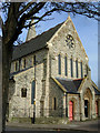
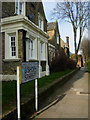
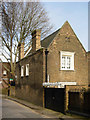
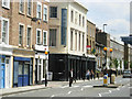
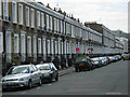
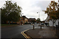
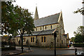
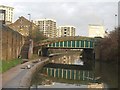
Photos of N1 3FG


Area Information
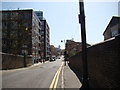
Living in N1 3FG means inhabiting a tightly knit residential cluster in north London, home to 1,444 residents. This small postcode area is characterised by its compact footprint and proximity to transport hubs, making it a practical choice for those prioritising connectivity. The community here skews towards adults aged 30–64, reflecting a mature demographic with established lifestyles. Daily life is shaped by the area’s accessibility to rail, metro, and bus networks, which link residents to central London and beyond. While the population is modest, the presence of five nearby retail outlets, including Tesco Southgate and Co-op Gainsborough, ensures basic amenities are within reach. The area’s compact nature means it is not suited to those seeking sprawling suburban living, but it offers a focused, efficient environment for those who value convenience over space.
- Area Type
- Postcode
- Area Size
- Not available
- Population
- 1444
- Population Density
- 17048 people/km²
The property market in N1 3FG is dominated by flats, with 19% of homes owned by residents. This low home ownership rate suggests the area is primarily a rental market, catering to tenants rather than buyers. The prevalence of flats indicates a compact, urban living environment, likely suited to individuals or couples seeking proximity to transport and amenities. For buyers, the small size of the area means property availability is limited, and competition may be fierce. The flat-dominated stock also implies that new builds or larger homes are rare, which could be a drawback for those seeking more space. However, the area’s connectivity and proximity to schools may offset these limitations for those prioritising location over property size.
House Prices in N1 3FG
No properties found in this postcode.
Energy Efficiency in N1 3FG
Residents of N1 3FG have access to a range of amenities within walking or short transit distance. Retail options include five nearby shops, such as Tesco Southgate and Co-op Gainsborough, providing essential goods. The area’s transport links to rail, metro, and bus networks open up access to broader leisure opportunities, from cultural venues in central London to parks and recreational spaces. Ferry piers like Blackfriars Pier and Tower Pier offer proximity to the Thames, while bus stops like Green Line Coach Station connect to regional routes. The mix of retail, transport, and waterfront access creates a dynamic lifestyle, blending urban convenience with occasional escapes to the river. However, the small size of the area means amenities are limited to what is immediately adjacent, requiring residents to venture further for more specialised services.
Amenities
Schools
Residents of N1 3FG have access to two nearby schools: Ecclesbourne Class Base (East) and Ecclesbourne Primary School. The latter is a primary school, which is critical for families with young children, while the former may cater to younger students or special needs education. The presence of both a primary school and a class base suggests a range of educational options, though no data is provided on Ofsted ratings or academic performance. For families, the availability of these schools within practical reach is a key consideration, as it reduces the need for long commutes. However, the area’s small size means it is unlikely to host a wide variety of educational institutions, which could be a limitation for those seeking specialist or secondary schooling.
| Rank | School | Type | Entry gender | Ages |
|---|
Explore more schools in this area
Go to Schools tabDemographics
The population of N1 3FG is predominantly adults aged 30–64, with a median age of 47. This suggests a community of middle-aged residents, many of whom may be in their prime working years or nearing retirement. Home ownership is relatively low at 19%, indicating that most households are renters. The accommodation type is largely flats, which aligns with the area’s density and proximity to transport infrastructure. The predominant ethnic group is White, though no data is provided on other ethnicities or diversity metrics. The age profile and ownership figures suggest a stable, long-term resident base rather than a transient population. For families, the presence of two schools—Ecclesbourne Primary School and Ecclesbourne Class Base (East)—may be a key draw, though the area’s small size limits the range of household types.
Household Size
Accommodation Type
Tenure
Ethnic Group
Religion
Household Composition
Age
Household Deprivation
NS-SEC
Explore more demographic insights in this area
Go to Demographics tabPlanning
Planning Constraints
- Flood RiskPremium
- Ramsar Wetland SitesPremium
- Area of Outstanding Natural BeautyPremium
- Protected Nature ReservePremium
- Protected WoodlandPremium